Saint-Jal geodata
Saint-Jal (Nouvelle-Aquitaine) is a populated place; located in France in Europe/Paris (GMT+2) time zone. With population of 611 people, there are 13143 cities with bigger population in this country. Compared to other cities in France, 75.3% of cities are located further ↑North; 61.1% of cities are located further →East and 90.3% of cities have lower elevation than Saint-Jal. Note1
Administrative division(s):
- Level 1: Nouvelle-Aquitaine
- Level 2: Département de la Corrèze
- Level 3: Arrondissement de Tulle
- Level 4: Saint-Jal


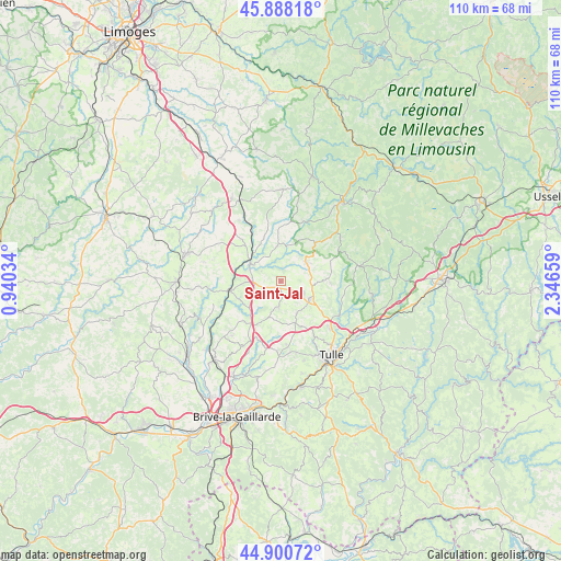
Saint-Jal GPS coordinates[2]
45° 23' 47.796" North, 1° 38' 36.456" East
| Map corner | latitude | longitude |
|---|---|---|
| Upper-left | 45.88818°, | 0.94034° |
| Center: | 45.39661°, | 1.64346° |
| Lower-right: | 44.90072°, | 2.34659° |
| Map W x H: | 109.8×109.8 km | = 68.2×68.2mi |
| max Lat: | 51.07786° ⇑75.3% North |
| Saint-Jal: | 45.39661° |
| min Lat: | ⇓24.7% South 41.3874° |
| min Long | Saint-Jal | max Long |
| -5.08615° | 1.64346° | 9.52242° |
| W 38.9%⇐ | ⇒61.1% E |
Elevation
Elevation of Saint-Jal is 433 m = 1421 ft, and this is 239.3 m = 785 ft above average elevation for this country.
| Max E: |
2333 m = 7654 ft | 9.7% |
| Saint-Jal | 433 m 1421 ft | |
| Avg. | 193.7 m = 635 ft | |
Min E: |
-1 m = -3 ft | 90.3% |
See also: France elevation on elevation.city.
Geographical zone
Saint-Jal is located in North temperate zone (between Tropic of Cancer and the Arctic Circle). Distance of this North polar circle is 2353.5 km =1462.4 mi to North.| Distance of | km | miles | from Saint-Jal |
|---|---|---|---|
| North Pole | 4959.4 | 3081.6 | to North |
| Arctic Circle | 2353.5 | 1462.4 | to North |
| Tropic Cancer | 2441.7 | 1517.2 | to South |
| Equator | 5047.6 | 3136.4 | to South |


Nearby cities:
15 places around Saint-Jal: (largest is in red/bold)
• Chamboulive
6.2 km =3.9 mi,  50°
50°
• Chanteix
9.7 km =6 mi,  182°
182°
• Condat-sur-Ganaveix
8.8 km =5.5 mi,  333°
333°
• Eyburie
7.1 km =4.4 mi,  355°
355°
• Lagraulière
4.9 km =3 mi, 184°
• Le Lonzac
10 km =6.2 mi,  41°
41°
• Naves
13.3 km =8.3 mi,  133°
133°
• Perpezac-le-Noir
10.6 km =6.6 mi,  222°
222°
• Saint-Clément
6.9 km =4.3 mi,  152°
152°
• Saint-Germain-les-Vergnes
13.7 km =8.5 mi, 182°
• Saint-Mexant
12.4 km =7.7 mi,  174°
174°
• Saint-Ybard
11.1 km =6.9 mi,  301°
301°
• Seilhac
6.4 km =4 mi,  120°
120°
• Uzerche
7 km =4.3 mi, 296°
• Vigeois
10 km =6.2 mi,  258°
258°
Sources, notices
• [Note1] Compared only with cities in France existing in our database
• [Src1] Map data: © OpenStreetMap contributors (CC-BY-SA)
• [Src2] Other city data from geonames.org with taken over terms of usage.
• [Src3] Geographical zone / Annual Mean Temperature by Robert A. Rohde @ Wikipedia
