Nogent-le-Rotrou geodata
Nogent-le-Rotrou (Centre) is a seat of a third-order administrative division; located in France in Europe/Paris (GMT+2) time zone. With population of 13,128 people, there are 726 cities with bigger population in this country. Compared to other cities in France, 65% of cities are located further ↓South; 70.3% of cities are located further →East and 54.5% of cities have lower elevation than Nogent-le-Rotrou. Note1
Administrative division(s):
- Level 1: Centre
- Level 2: Département d'Eure-et-Loir
- Level 3: Arrondissement de Nogent-le-Rotrou
- Level 4: Nogent-le-Rotrou


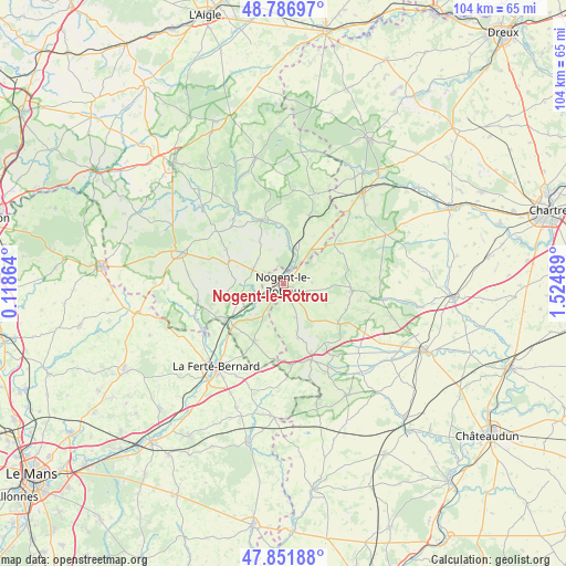
Nogent-le-Rotrou GPS coordinates[2]
48° 19' 17.652" North, 0° 49' 18.372" East
| Map corner | latitude | longitude |
|---|---|---|
| Upper-left | 48.78697°, | 0.11864° |
| Center: | 48.32157°, | 0.82177° |
| Lower-right: | 47.85188°, | 1.52489° |
| Map W x H: | 104×104 km | = 64.6×64.6mi |
| max Lat: | 51.07786° ⇑35% North |
| Nogent-le-Rotrou: | 48.32157° |
| min Lat: | ⇓65% South 41.3874° |
| min Long | Nogent-le-Rotro | max Long |
| -5.08615° | 0.82177° | 9.52242° |
| W 29.7%⇐ | ⇒70.3% E |
Elevation
Elevation of Nogent-le-Rotrou is 148 m = 486 ft, and this is 45.7 m = 150 ft below average elevation for this country.
| Max E: |
2333 m = 7654 ft | 45.5% |
| Avg. | 193.7 m = 635 ft | |
| Nogent-le-Rotrou | 148 m = 486 ft | |
Min E: |
-1 m = -3 ft | 54.5% |
See also: France elevation on elevation.city.
Geographical zone
Nogent-le-Rotrou is located in North temperate zone (between Tropic of Cancer and the Arctic Circle). Distance of this North polar circle is 2028.3 km =1260.3 mi to North.| Distance of | km | miles | from Nogent-le-Rotrou |
|---|---|---|---|
| North Pole | 4634.2 | 2879.6 | to North |
| Arctic Circle | 2028.3 | 1260.3 | to North |
| Tropic Cancer | 2766.9 | 1719.3 | to South |
| Equator | 5372.9 | 3338.6 | to South |


Nearby cities:
15 places around Nogent-le-Rotrou: (largest is in red/bold)
• Authon-du-Perche
14.9 km =9.3 mi,  159°
159°
• Beaumont-les-Autels
12.4 km =7.7 mi,  124°
124°
• Bretoncelles
13.1 km =8.1 mi,  21°
21°
• Brunelles
5.3 km =3.3 mi,  86°
86°
• Ceton
11.9 km =7.4 mi,  206°
206°
• Condé-sur-Huisne
7 km =4.3 mi, 18°
• La Rouge
9.2 km =5.7 mi,  245°
245°
• Margon
1.8 km =1.1 mi,  31°
31°
• Mâle
8.3 km =5.2 mi,  228°
228°
• Nocé
12.2 km =7.6 mi,  301°
301°
• Préaux-du-Perche
7.9 km =4.9 mi,  279°
279°
• Rémalard
12.5 km =7.8 mi,  342°
342°
• Saint-Hilaire-sur-Erre
6.2 km =3.9 mi,  260°
260°
• Souancé-au-Perche
6.6 km =4.1 mi, 157°
• Thiron Gardais
12 km =7.5 mi, 92°
Sources, notices
• [Note1] Compared only with cities in France existing in our database
• [Src1] Map data: © OpenStreetMap contributors (CC-BY-SA)
• [Src2] Other city data from geonames.org with taken over terms of usage.
• [Src3] Geographical zone / Annual Mean Temperature by Robert A. Rohde @ Wikipedia
