Souancé-au-Perche geodata
Souancé-au-Perche (Centre) is a populated place; located in France in Europe/Paris (GMT+2) time zone. With population of 531 people, there are 14589 cities with bigger population in this country. Compared to other cities in France, 63.9% of cities are located further ↓South; 70.1% of cities are located further →East and 51.7% of cities have lower elevation than Souancé-au-Perche. Note1
Administrative division(s):
- Level 1: Centre
- Level 2: Département d'Eure-et-Loir
- Level 3: Arrondissement de Nogent-le-Rotrou
- Level 4: Souancé-au-Perche


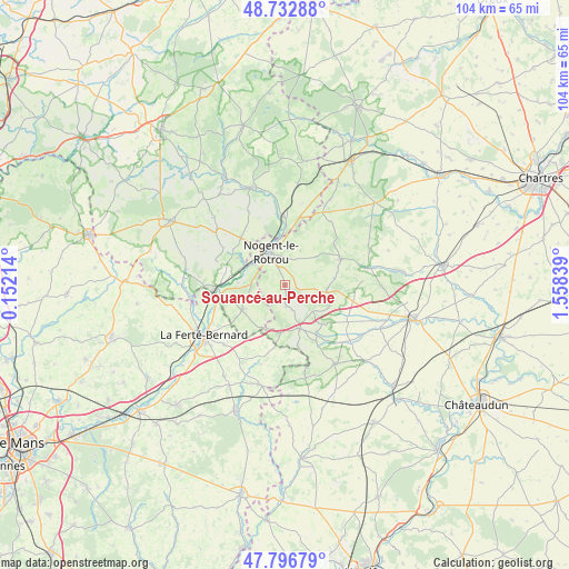
Souancé-au-Perche GPS coordinates[2]
48° 16' 1.128" North, 0° 51' 18.972" East
| Map corner | latitude | longitude |
|---|---|---|
| Upper-left | 48.73288°, | 0.15214° |
| Center: | 48.26698°, | 0.85527° |
| Lower-right: | 47.79679°, | 1.55839° |
| Map W x H: | 104.1×104.1 km | = 64.7×64.7mi |
| max Lat: | 51.07786° ⇑36.1% North |
| Souancé-au-Perche: | 48.26698° |
| min Lat: | ⇓63.9% South 41.3874° |
| min Long | Souancé-au-Per | max Long |
| -5.08615° | 0.85527° | 9.52242° |
| W 29.9%⇐ | ⇒70.1% E |
Elevation
Elevation of Souancé-au-Perche is 138 m = 453 ft, and this is 55.7 m = 183 ft below average elevation for this country.
| Max E: |
2333 m = 7654 ft | 48.3% |
| Avg. | 193.7 m = 635 ft | |
| Souancé-au-Perche | 138 m = 453 ft | |
Min E: |
-1 m = -3 ft | 51.7% |
See also: France elevation on elevation.city.
Geographical zone
Souancé-au-Perche is located in North temperate zone (between Tropic of Cancer and the Arctic Circle). Distance of this North polar circle is 2034.4 km =1264.1 mi to North.| Distance of | km | miles | from Souancé-au-Perche |
|---|---|---|---|
| North Pole | 4640.3 | 2883.3 | to North |
| Arctic Circle | 2034.4 | 1264.1 | to North |
| Tropic Cancer | 2760.9 | 1715.5 | to South |
| Equator | 5366.8 | 3334.8 | to South |


Nearby cities:
15 places around Souancé-au-Perche: (largest is in red/bold)
• Authon-du-Perche
8.3 km =5.2 mi,  160°
160°
• Avezé
13.9 km =8.6 mi,  251°
251°
• Beaumont-les-Autels
7.8 km =4.8 mi,  97°
97°
• Brunelles
7 km =4.3 mi,  23°
23°
• Ceton
9 km =5.6 mi,  239°
239°
• Cherreau
15.1 km =9.4 mi, 237°
• Condé-sur-Huisne
12.7 km =7.9 mi,  358°
358°
• Cormes
15.6 km =9.7 mi,  225°
225°
• La Rouge
11.1 km =6.9 mi,  281°
281°
• Margon
7.8 km =4.8 mi,  348°
348°
• Mâle
8.7 km =5.4 mi,  273°
273°
• Nogent-le-Rotrou
6.6 km =4.1 mi,  337°
337°
• Préaux-du-Perche
12.6 km =7.8 mi,  305°
305°
• Saint-Hilaire-sur-Erre
10 km =6.2 mi,  300°
300°
• Thiron Gardais
11 km =6.8 mi,  59°
59°
Sources, notices
• [Note1] Compared only with cities in France existing in our database
• [Src1] Map data: © OpenStreetMap contributors (CC-BY-SA)
• [Src2] Other city data from geonames.org with taken over terms of usage.
• [Src3] Geographical zone / Annual Mean Temperature by Robert A. Rohde @ Wikipedia
