Margon geodata
Margon (Centre) is a populated place; located in France in Europe/Paris (GMT+2) time zone. With population of 1,292 people, there are 7073 cities with bigger population in this country. Compared to other cities in France, 65.2% of cities are located further ↓South; 70.3% of cities are located further →East and 51.4% of cities have higher elevation than Margon. Note1
Administrative division(s):
- Level 1: Centre
- Level 2: Département d'Eure-et-Loir
- Level 3: Arrondissement de Nogent-le-Rotrou
- Level 4: Arcisses


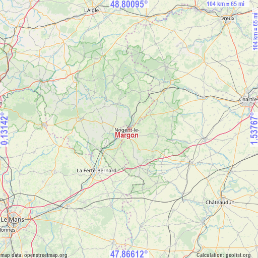
Margon GPS coordinates[2]
48° 20' 8.448" North, 0° 50' 4.344" East
| Map corner | latitude | longitude |
|---|---|---|
| Upper-left | 48.80095°, | 0.13142° |
| Center: | 48.33568°, | 0.83454° |
| Lower-right: | 47.86612°, | 1.53767° |
| Map W x H: | 103.9×103.9 km | = 64.6×64.6mi |
| max Lat: | 51.07786° ⇑34.8% North |
| Margon: | 48.33568° |
| min Lat: | ⇓65.2% South 41.3874° |
| min Long | Margon | max Long |
| -5.08615° | 0.83454° | 9.52242° |
| W 29.7%⇐ | ⇒70.3% E |
Elevation
Elevation of Margon is 127 m = 417 ft, and this is 66.7 m = 219 ft below average elevation for this country.
| Max E: |
2333 m = 7654 ft | 51.4% |
| Avg. | 193.7 m = 635 ft | |
| Margon | 127 m = 417 ft | |
Min E: |
-1 m = -3 ft | 48.6% |
See also: France elevation on elevation.city.
Geographical zone
Margon is located in North temperate zone (between Tropic of Cancer and the Arctic Circle). Distance of this North polar circle is 2026.8 km =1259.4 mi to North.| Distance of | km | miles | from Margon |
|---|---|---|---|
| North Pole | 4632.6 | 2878.6 | to North |
| Arctic Circle | 2026.8 | 1259.4 | to North |
| Tropic Cancer | 2768.5 | 1720.3 | to South |
| Equator | 5374.4 | 3339.5 | to South |


Nearby cities:
15 places around Margon: (largest is in red/bold)
• Beaumont-les-Autels
12.7 km =7.9 mi,  133°
133°
• Bretoncelles
11.3 km =7 mi,  20°
20°
• Brunelles
4.5 km =2.8 mi,  106°
106°
• Ceton
13.7 km =8.5 mi,  207°
207°
• Condé-sur-Huisne
5.2 km =3.2 mi,  13°
13°
• La Rouge
10.7 km =6.6 mi,  239°
239°
• Moutiers-au-Perche
15.7 km =9.8 mi,  3°
3°
• Mâle
10.1 km =6.3 mi,  224°
224°
• Nocé
12.3 km =7.6 mi,  293°
293°
• Nogent-le-Rotrou
1.8 km =1.1 mi, 211°
• Préaux-du-Perche
8.7 km =5.4 mi,  268°
268°
• Rémalard
11.3 km =7 mi,  335°
335°
• Saint-Hilaire-sur-Erre
7.5 km =4.7 mi,  249°
249°
• Souancé-au-Perche
7.8 km =4.8 mi,  168°
168°
• Thiron Gardais
11.2 km =7 mi,  100°
100°
Sources, notices
• [Note1] Compared only with cities in France existing in our database
• [Src1] Map data: © OpenStreetMap contributors (CC-BY-SA)
• [Src2] Other city data from geonames.org with taken over terms of usage.
• [Src3] Geographical zone / Annual Mean Temperature by Robert A. Rohde @ Wikipedia
