Langourla geodata
Langourla (Brittany) is a populated place; located in France in Europe/Paris (GMT+2) time zone. With population of 636 people, there are 12726 cities with bigger population in this country. Compared to other cities in France, 64.3% of cities are located further ↓South; 96% of cities are located further →East and 61.6% of cities have lower elevation than Langourla. Note1
Administrative division(s):
- Level 1: Brittany
- Level 2: Département des Côtes-d’Armor
- Level 3: Arrondissement de Saint-Brieuc
- Level 4: Le Mené


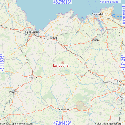
Langourla GPS coordinates[2]
48° 17' 3.912" North, 2° 24' 54.792" West
| Map corner | latitude | longitude |
|---|---|---|
| Upper-left | 48.75016°, | -3.11835° |
| Center: | 48.28442°, | -2.41522° |
| Lower-right: | 47.81439°, | -1.7121° |
| Map W x H: | 104×104 km | = 64.6×64.6mi |
| max Lat: | 51.07786° ⇑35.7% North |
| Langourla: | 48.28442° |
| min Lat: | ⇓64.3% South 41.3874° |
| min Long | Langourla | max Long |
| -5.08615° | -2.41522° | 9.52242° |
| W 4%⇐ | ⇒96% E |
Elevation
Elevation of Langourla is 178 m = 584 ft, and this is 15.7 m = 52 ft below average elevation for this country.
| Max E: |
2333 m = 7654 ft | 38.4% |
| Avg. | 193.7 m = 635 ft | |
| Langourla | 178 m = 584 ft | |
Min E: |
-1 m = -3 ft | 61.6% |
See also: France elevation on elevation.city.
Geographical zone
Langourla is located in North temperate zone (between Tropic of Cancer and the Arctic Circle). Distance of this North polar circle is 2032.4 km =1262.9 mi to North.| Distance of | km | miles | from Langourla |
|---|---|---|---|
| North Pole | 4638.3 | 2882.1 | to North |
| Arctic Circle | 2032.4 | 1262.9 | to North |
| Tropic Cancer | 2762.8 | 1716.7 | to South |
| Equator | 5368.7 | 3336 | to South |


Nearby cities:
15 places around Langourla: (largest is in red/bold)
• Broons
12.1 km =7.5 mi,  72°
72°
• Collinée
7.8 km =4.8 mi,  282°
282°
• Lanrelas
9.3 km =5.8 mi,  114°
114°
• Laurenan
13 km =8.1 mi,  222°
222°
• Le Gouray
7.2 km =4.5 mi,  311°
311°
• Merdrignac
10.1 km =6.3 mi,  180°
180°
• Plénée-Jugon
9 km =5.6 mi,  7°
7°
• Saint-Glen
11.5 km =7.1 mi,  315°
315°
• Saint-Gouéno
11.4 km =7.1 mi,  260°
260°
• Saint-Jacut-du-Mené
5.1 km =3.2 mi,  266°
266°
• Saint-Vran
5.8 km =3.6 mi,  200°
200°
• Sévignac
7.8 km =4.8 mi,  46°
46°
• Tramain
13 km =8.1 mi,  4°
4°
• Trébry
12.7 km =7.9 mi, 307°
• Éréac
5.2 km =3.2 mi,  102°
102°
Sources, notices
• [Note1] Compared only with cities in France existing in our database
• [Src1] Map data: © OpenStreetMap contributors (CC-BY-SA)
• [Src2] Other city data from geonames.org with taken over terms of usage.
• [Src3] Geographical zone / Annual Mean Temperature by Robert A. Rohde @ Wikipedia
