Moutiers-au-Perche geodata
Moutiers-au-Perche (Normandy) is a populated place; located in France in Europe/Paris (GMT+2) time zone. With population of 515 people, there are 14927 cities with bigger population in this country. Compared to other cities in France, 67.8% of cities are located further ↓South; 70.2% of cities are located further →East and 58% of cities have lower elevation than Moutiers-au-Perche. Note1
Administrative division(s):
- Level 1: Normandy
- Level 2: Département de l'Orne
- Level 3: Arrondissement de Mortagne-au-Perche
- Level 4: Moutiers-au-Perche


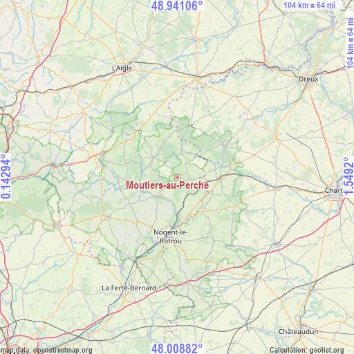
Moutiers-au-Perche GPS coordinates[2]
48° 28' 37.488" North, 0° 50' 45.852" East
| Map corner | latitude | longitude |
|---|---|---|
| Upper-left | 48.94106°, | 0.14294° |
| Center: | 48.47708°, | 0.84607° |
| Lower-right: | 48.00882°, | 1.5492° |
| Map W x H: | 103.7×103.7 km | = 64.4×64.4mi |
| max Lat: | 51.07786° ⇑32.2% North |
| Moutiers-au-Perche: | 48.47708° |
| min Lat: | ⇓67.8% South 41.3874° |
| min Long | Moutiers-au-Per | max Long |
| -5.08615° | 0.84607° | 9.52242° |
| W 29.8%⇐ | ⇒70.2% E |
Elevation
Elevation of Moutiers-au-Perche is 161 m = 528 ft, and this is 32.7 m = 107 ft below average elevation for this country.
| Max E: |
2333 m = 7654 ft | 42% |
| Avg. | 193.7 m = 635 ft | |
| Moutiers-au-Perche | 161 m = 528 ft | |
Min E: |
-1 m = -3 ft | 58% |
See also: France elevation on elevation.city.
Geographical zone
Moutiers-au-Perche is located in North temperate zone (between Tropic of Cancer and the Arctic Circle). Distance of this North polar circle is 2011 km =1249.6 mi to North.| Distance of | km | miles | from Moutiers-au-Perche |
|---|---|---|---|
| North Pole | 4616.9 | 2868.8 | to North |
| Arctic Circle | 2011 | 1249.6 | to North |
| Tropic Cancer | 2784.2 | 1730 | to South |
| Equator | 5390.1 | 3349.3 | to South |


Nearby cities:
15 places around Moutiers-au-Perche: (largest is in red/bold)
• Belhomert-Guéhouville
16 km =9.9 mi,  78°
78°
• Bretoncelles
6 km =3.7 mi,  148°
148°
• Condé-sur-Huisne
10.7 km =6.6 mi,  178°
178°
• Fontaine-Simon
13.1 km =8.1 mi, 76°
• La Chapelle-Montligeon
14 km =8.7 mi,  272°
272°
• La Ferté-Vidame
15.5 km =9.6 mi,  15°
15°
• La Loupe
12.5 km =7.8 mi,  91°
91°
• Longny-au-Perche
9.1 km =5.7 mi,  310°
310°
• Manou
10.9 km =6.8 mi,  64°
64°
• Margon
15.7 km =9.8 mi, 183°
• Meaucé
11.6 km =7.2 mi, 84°
• Neuilly-sur-Eure
8.4 km =5.2 mi,  30°
30°
• Nocé
16.3 km =10.1 mi,  228°
228°
• Rémalard
7.7 km =4.8 mi, 225°
• Saint-Éliph
13.6 km =8.5 mi,  102°
102°
Sources, notices
• [Note1] Compared only with cities in France existing in our database
• [Src1] Map data: © OpenStreetMap contributors (CC-BY-SA)
• [Src2] Other city data from geonames.org with taken over terms of usage.
• [Src3] Geographical zone / Annual Mean Temperature by Robert A. Rohde @ Wikipedia
