Rosans geodata
Rosans (Provence-Alpes-Côte d'Azur) is a populated place; located in France in Europe/Paris (GMT+2) time zone. With population of 526 people, there are 14691 cities with bigger population in this country. Compared to other cities in France, 84.3% of cities are located further ↑North; 82.6% of cities are located further ←West and 97.4% of cities have lower elevation than Rosans. Note1
Administrative division(s):
- Level 1: Provence-Alpes-Côte d'Azur
- Level 2: Hautes-Alpes
- Level 3: Arrondissement de Gap
- Level 4: Rosans


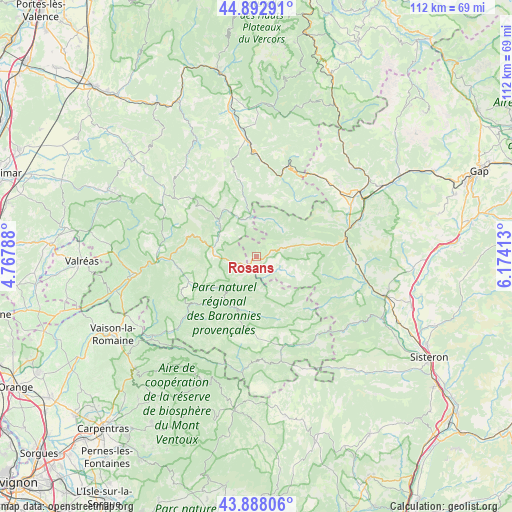
Rosans GPS coordinates[2]
44° 23' 33.504" North, 5° 28' 15.6" East
| Map corner | latitude | longitude |
|---|---|---|
| Upper-left | 44.89291°, | 4.76788° |
| Center: | 44.39264°, | 5.471° |
| Lower-right: | 43.88806°, | 6.17413° |
| Map W x H: | 111.7×111.7 km | = 69.4×69.4mi |
| max Lat: | 51.07786° ⇑84.3% North |
| Rosans: | 44.39264° |
| min Lat: | ⇓15.7% South 41.3874° |
| min Long | Rosans | max Long |
| -5.08615° | 5.471° | 9.52242° |
| W 82.6%⇐ | ⇒17.4% E |
Elevation
Elevation of Rosans is 760 m = 2493 ft, and this is 566.3 m = 1858 ft above average elevation for this country.
| Max E: |
2333 m = 7654 ft | 2.6% |
| Rosans | 760 m 2493 ft | |
| Avg. | 193.7 m = 635 ft | |
Min E: |
-1 m = -3 ft | 97.4% |
See also: France elevation on elevation.city.
Geographical zone
Rosans is located in North temperate zone (between Tropic of Cancer and the Arctic Circle). Distance of this Northern Tropic circle is 2330.1 km =1447.9 mi to South.| Distance of | km | miles | from Rosans |
|---|---|---|---|
| North Pole | 5071.1 | 3151 | to North |
| Arctic Circle | 2465.2 | 1531.8 | to North |
| Tropic Cancer | 2330.1 | 1447.9 | to South |
| Equator | 4936 | 3067.1 | to South |


Nearby cities:
15 places around Rosans: (largest is in red/bold)
• Aspres-sur-Buëch
26.6 km =16.5 mi,  57°
57°
• Buis-les-Baronnies
20.4 km =12.7 mi,  230°
230°
• Condorcet
21.6 km =13.4 mi,  274°
274°
• Entrechaux
32.9 km =20.4 mi, 233°
• Laragne-Montéglin
28.8 km =17.9 mi,  107°
107°
• Luc-en-Diois
24.8 km =15.4 mi,  356°
356°
• Mirabel-aux-Baronnies
30.9 km =19.2 mi,  252°
252°
• Mison
32.6 km =20.3 mi,  115°
115°
• Mollans-sur-Ouvèze
28.3 km =17.6 mi, 232°
• Nyons
26.5 km =16.5 mi,  262°
262°
• Puyméras
30.5 km =19 mi,  243°
243°
• Saint-Romain-en-Viennois
32.4 km =20.1 mi, 242°
• Serres
19.7 km =12.2 mi,  78°
78°
• Venterol
29.4 km =18.3 mi, 269°
• Veynes
32.1 km =19.9 mi, 60°
Sources, notices
• [Note1] Compared only with cities in France existing in our database
• [Src1] Map data: © OpenStreetMap contributors (CC-BY-SA)
• [Src2] Other city data from geonames.org with taken over terms of usage.
• [Src3] Geographical zone / Annual Mean Temperature by Robert A. Rohde @ Wikipedia
