Serres geodata
Serres (Provence-Alpes-Côte d'Azur) is a populated place; located in France in Europe/Paris (GMT+2) time zone. With population of 1,291 people, there are 7077 cities with bigger population in this country. Compared to other cities in France, 84.1% of cities are located further ↑North; 84.5% of cities are located further ←West and 96.9% of cities have lower elevation than Serres. Note1
Administrative division(s):
- Level 1: Provence-Alpes-Côte d'Azur
- Level 2: Hautes-Alpes
- Level 3: Arrondissement de Gap
- Level 4: Serres


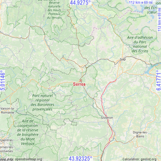
Serres GPS coordinates[2]
44° 25' 39.108" North, 5° 42' 52.488" East
| Map corner | latitude | longitude |
|---|---|---|
| Upper-left | 44.9275°, | 5.01146° |
| Center: | 44.42753°, | 5.71458° |
| Lower-right: | 43.92325°, | 6.41771° |
| Map W x H: | 111.7×111.7 km | = 69.4×69.4mi |
| max Lat: | 51.07786° ⇑84.1% North |
| Serres: | 44.42753° |
| min Lat: | ⇓15.9% South 41.3874° |
| min Long | Serres | max Long |
| -5.08615° | 5.71458° | 9.52242° |
| W 84.5%⇐ | ⇒15.5% E |
Elevation
Elevation of Serres is 720 m = 2362 ft, and this is 526.3 m = 1727 ft above average elevation for this country.
| Max E: |
2333 m = 7654 ft | 3.1% |
| Serres | 720 m 2362 ft | |
| Avg. | 193.7 m = 635 ft | |
Min E: |
-1 m = -3 ft | 96.9% |
See also: France elevation on elevation.city.
Geographical zone
Serres is located in North temperate zone (between Tropic of Cancer and the Arctic Circle). Distance of this Northern Tropic circle is 2334 km =1450.3 mi to South.| Distance of | km | miles | from Serres |
|---|---|---|---|
| North Pole | 5067.2 | 3148.6 | to North |
| Arctic Circle | 2461.3 | 1529.4 | to North |
| Tropic Cancer | 2334 | 1450.3 | to South |
| Equator | 4939.9 | 3069.5 | to South |


Nearby cities:
15 places around Serres: (largest is in red/bold)
• Aspres-sur-Buëch
11 km =6.8 mi,  15°
15°
• La Motte-du-Caire
26.6 km =16.5 mi,  110°
110°
• La Roche-des-Arnauds
24.2 km =15 mi,  51°
51°
• La Saulce
23.2 km =14.4 mi,  90°
90°
• Laragne-Montéglin
14.8 km =9.2 mi,  146°
146°
• Luc-en-Diois
29.5 km =18.3 mi,  315°
315°
• Mison
20.7 km =12.9 mi, 151°
• Neffes
25.9 km =16.1 mi,  70°
70°
• Ribiers
24.6 km =15.3 mi, 152°
• Rosans
19.7 km =12.2 mi,  258°
258°
• Sigoyer
21.5 km =13.4 mi, 74°
• Sisteron
32.2 km =20 mi, 145°
• Tallard
27.1 km =16.8 mi,  81°
81°
• Ventavon
16.4 km =10.2 mi, 112°
• Veynes
14.6 km =9.1 mi,  36°
36°
Sources, notices
• [Note1] Compared only with cities in France existing in our database
• [Src1] Map data: © OpenStreetMap contributors (CC-BY-SA)
• [Src2] Other city data from geonames.org with taken over terms of usage.
• [Src3] Geographical zone / Annual Mean Temperature by Robert A. Rohde @ Wikipedia
