Aspres-sur-Buëch geodata
Aspres-sur-Buëch (Provence-Alpes-Côte d'Azur) is a populated place; located in France in Europe/Paris (GMT+2) time zone. With population of 720 people, there are 11535 cities with bigger population in this country. Compared to other cities in France, 83.4% of cities are located further ↑North; 84.7% of cities are located further ←West and 97.4% of cities have lower elevation than Aspres-sur-Buëch. Note1
Administrative division(s):
- Level 1: Provence-Alpes-Côte d'Azur
- Level 2: Hautes-Alpes
- Level 3: Arrondissement de Gap
- Level 4: Aspres-sur-Buëch


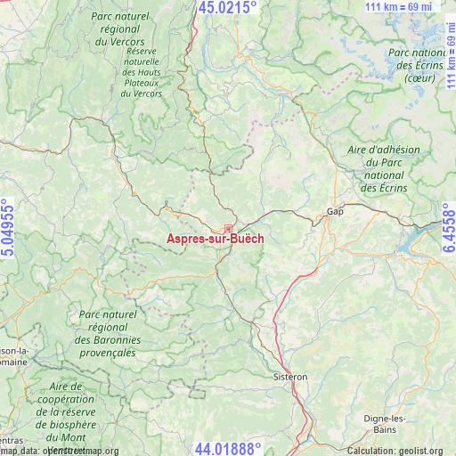
Aspres-sur-Buëch GPS coordinates[2]
44° 31' 20.46" North, 5° 45' 9.648" East
| Map corner | latitude | longitude |
|---|---|---|
| Upper-left | 45.0215°, | 5.04955° |
| Center: | 44.52235°, | 5.75268° |
| Lower-right: | 44.01888°, | 6.4558° |
| Map W x H: | 111.5×111.5 km | = 69.3×69.3mi |
| max Lat: | 51.07786° ⇑83.4% North |
| Aspres-sur-Buëch: | 44.52235° |
| min Lat: | ⇓16.6% South 41.3874° |
| min Long | Aspres-sur-Buë | max Long |
| -5.08615° | 5.75268° | 9.52242° |
| W 84.7%⇐ | ⇒15.3% E |
Elevation
Elevation of Aspres-sur-Buëch is 759 m = 2490 ft, and this is 565.3 m = 1855 ft above average elevation for this country.
| Max E: |
2333 m = 7654 ft | 2.6% |
| Aspres-sur-Buëch | 759 m 2490 ft | |
| Avg. | 193.7 m = 635 ft | |
Min E: |
-1 m = -3 ft | 97.4% |
See also: France elevation on elevation.city.
Geographical zone
Aspres-sur-Buëch is located in North temperate zone (between Tropic of Cancer and the Arctic Circle). Distance of this Northern Tropic circle is 2344.5 km =1456.8 mi to South.| Distance of | km | miles | from Aspres-sur-Buëch |
|---|---|---|---|
| North Pole | 5056.6 | 3142 | to North |
| Arctic Circle | 2450.8 | 1522.9 | to North |
| Tropic Cancer | 2344.5 | 1456.8 | to South |
| Equator | 4950.4 | 3076 | to South |


Nearby cities:
15 places around Aspres-sur-Buëch: (largest is in red/bold)
• Châtillon-en-Diois
29 km =18 mi,  310°
310°
• Gap
26.1 km =16.2 mi,  81°
81°
• La Motte-du-Caire
29.5 km =18.3 mi,  132°
132°
• La Roche-des-Arnauds
16.7 km =10.4 mi,  74°
74°
• La Saulce
22.9 km =14.2 mi,  118°
118°
• Laragne-Montéglin
23.4 km =14.5 mi,  167°
167°
• Le Dévoluy
24.2 km =15 mi,  37°
37°
• Luc-en-Diois
26 km =16.2 mi,  293°
293°
• Neffes
21.4 km =13.3 mi,  95°
95°
• Rosans
26.6 km =16.5 mi,  237°
237°
• Serres
11 km =6.8 mi,  195°
195°
• Sigoyer
18.4 km =11.4 mi,  105°
105°
• Tallard
24.7 km =15.3 mi, 105°
• Ventavon
20.8 km =12.9 mi,  144°
144°
• Veynes
5.7 km =3.5 mi, 76°
Sources, notices
• [Note1] Compared only with cities in France existing in our database
• [Src1] Map data: © OpenStreetMap contributors (CC-BY-SA)
• [Src2] Other city data from geonames.org with taken over terms of usage.
• [Src3] Geographical zone / Annual Mean Temperature by Robert A. Rohde @ Wikipedia
