Berthecourt geodata
Berthecourt (Hauts-de-France) is a populated place; located in France in Europe/Paris (GMT+2) time zone. With population of 1,416 people, there are 6536 cities with bigger population in this country. Compared to other cities in France, 87.1% of cities are located further ↓South; 54% of cities are located further →East and 78.2% of cities have higher elevation than Berthecourt. Note1
Administrative division(s):
- Level 1: Hauts-de-France
- Level 2: Département de l'Oise
- Level 3: Arrondissement de Beauvais
- Level 4: Berthecourt


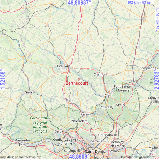
Berthecourt GPS coordinates[2]
49° 21' 3.492" North, 2° 13' 28.956" East
| Map corner | latitude | longitude |
|---|---|---|
| Upper-left | 49.80687°, | 1.52158° |
| Center: | 49.35097°, | 2.22471° |
| Lower-right: | 48.8908°, | 2.92783° |
| Map W x H: | 101.9×101.9 km | = 63.3×63.3mi |
| max Lat: | 51.07786° ⇑12.9% North |
| Berthecourt: | 49.35097° |
| min Lat: | ⇓87.1% South 41.3874° |
| min Long | Berthecourt | max Long |
| -5.08615° | 2.22471° | 9.52242° |
| W 46%⇐ | ⇒54% E |
Elevation
Elevation of Berthecourt is 59 m = 194 ft, and this is 134.7 m = 442 ft below average elevation for this country.
| Max E: |
2333 m = 7654 ft | 78.2% |
| Avg. | 193.7 m = 635 ft | |
| Berthecourt | 59 m = 194 ft | |
Min E: |
-1 m = -3 ft | 21.8% |
See also: France elevation on elevation.city.
Geographical zone
Berthecourt is located in North temperate zone (between Tropic of Cancer and the Arctic Circle). Distance of this North polar circle is 1913.9 km =1189.2 mi to North.| Distance of | km | miles | from Berthecourt |
|---|---|---|---|
| North Pole | 4519.7 | 2808.4 | to North |
| Arctic Circle | 1913.9 | 1189.2 | to North |
| Tropic Cancer | 2881.4 | 1790.4 | to South |
| Equator | 5487.3 | 3409.6 | to South |


Nearby cities:
15 places around Berthecourt: (largest is in red/bold)
• Bailleul-sur-Thérain
3.8 km =2.4 mi,  357°
357°
• Bresles
6.9 km =4.3 mi,  15°
15°
• Cauvigny
5.7 km =3.5 mi,  162°
162°
• Heilles
3.5 km =2.2 mi,  120°
120°
• Hermes
1.8 km =1.1 mi,  54°
54°
• Hondainville
5.7 km =3.5 mi,  101°
101°
• Noailles
3 km =1.9 mi,  215°
215°
• Ponchon
2.1 km =1.3 mi,  256°
256°
• Rochy-Condé
6.3 km =3.9 mi,  332°
332°
• Saint-Félix
4.3 km =2.7 mi,  79°
79°
• Saint-Sulpice
7.4 km =4.6 mi,  269°
269°
• Sainte-Geneviève
7.1 km =4.4 mi,  195°
195°
• Thury-sous-Clermont
7.6 km =4.7 mi, 84°
• Villers-Saint-Sépulcre
1.8 km =1.1 mi,  338°
338°
• Warluis
7.3 km =4.5 mi,  305°
305°
Sources, notices
• [Note1] Compared only with cities in France existing in our database
• [Src1] Map data: © OpenStreetMap contributors (CC-BY-SA)
• [Src2] Other city data from geonames.org with taken over terms of usage.
• [Src3] Geographical zone / Annual Mean Temperature by Robert A. Rohde @ Wikipedia
