Vézins-de-Lévézou geodata
Vézins-de-Lévézou (Occitanie) is a populated place; located in France in Europe/Paris (GMT+2) time zone. With population of 664 people, there are 12308 cities with bigger population in this country. Compared to other cities in France, 85% of cities are located further ↑North; 57.1% of cities are located further ←West and 98.9% of cities have lower elevation than Vézins-de-Lévézou. Note1
Administrative division(s):
- Level 1: Occitanie
- Level 2: Département de l'Aveyron
- Level 3: Arrondissement de Millau
- Level 4: Vézins-de-Lévézou


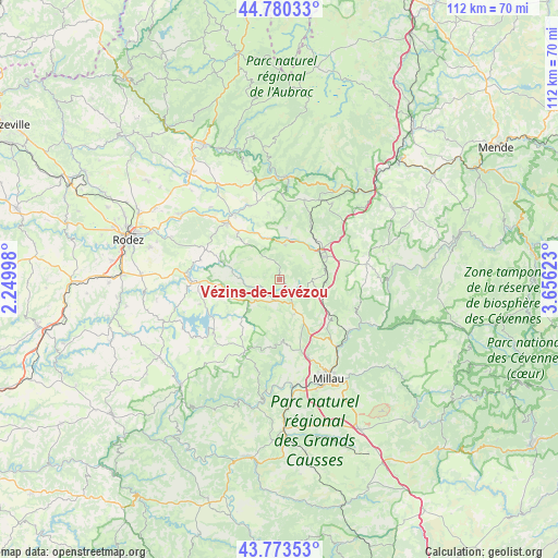
Vézins-de-Lévézou GPS coordinates[2]
44° 16' 44.724" North, 2° 57' 11.196" East
| Map corner | latitude | longitude |
|---|---|---|
| Upper-left | 44.78033°, | 2.24998° |
| Center: | 44.27909°, | 2.95311° |
| Lower-right: | 43.77353°, | 3.65623° |
| Map W x H: | 111.9×111.9 km | = 69.5×69.5mi |
| max Lat: | 51.07786° ⇑85% North |
| Vézins-de-Lévézou: | 44.27909° |
| min Lat: | ⇓15% South 41.3874° |
| min Long | Vézins-de-Lév | max Long |
| -5.08615° | 2.95311° | 9.52242° |
| W 57.1%⇐ | ⇒42.9% E |
Elevation
Elevation of Vézins-de-Lévézou is 937 m = 3074 ft, and this is 743.3 m = 2439 ft above average elevation for this country.
| Max E: |
2333 m = 7654 ft | 1.1% |
| Vézins-de-Lévézou | 937 m 3074 ft | |
| Avg. | 193.7 m = 635 ft | |
Min E: |
-1 m = -3 ft | 98.9% |
See also: France elevation on elevation.city.
Geographical zone
Vézins-de-Lévézou is located in North temperate zone (between Tropic of Cancer and the Arctic Circle). Distance of this Northern Tropic circle is 2317.5 km =1440 mi to South.| Distance of | km | miles | from Vézins-de-Lévézou |
|---|---|---|---|
| North Pole | 5083.7 | 3158.9 | to North |
| Arctic Circle | 2477.8 | 1539.6 | to North |
| Tropic Cancer | 2317.5 | 1440 | to South |
| Equator | 4923.4 | 3059.3 | to South |


Nearby cities:
15 places around Vézins-de-Lévézou: (largest is in red/bold)
• Aguessac
17.9 km =11.1 mi,  139°
139°
• Bertholène
18.9 km =11.7 mi,  313°
313°
• Compeyre
17.7 km =11 mi, 137°
• Creissels
23.1 km =14.4 mi,  158°
158°
• Laissac
15.4 km =9.6 mi,  317°
317°
• Lapanouse
8.9 km =5.5 mi,  44°
44°
• Millau
22.5 km =14 mi,  153°
153°
• Pont-de-Salars
17.9 km =11.1 mi,  270°
270°
• Rivière-sur-Tarn
17.4 km =10.8 mi,  125°
125°
• Saint-Beauzély
12.6 km =7.8 mi,  178°
178°
• Saint-Geniez-d’Olt
20.8 km =12.9 mi,  4°
4°
• Salles-Curan
17 km =10.6 mi,  230°
230°
• Ségur
9.5 km =5.9 mi,  278°
278°
• Sévérac-le-Château
9.8 km =6.1 mi,  59°
59°
• Viala-du-Tarn
23.8 km =14.8 mi,  194°
194°
Sources, notices
• [Note1] Compared only with cities in France existing in our database
• [Src1] Map data: © OpenStreetMap contributors (CC-BY-SA)
• [Src2] Other city data from geonames.org with taken over terms of usage.
• [Src3] Geographical zone / Annual Mean Temperature by Robert A. Rohde @ Wikipedia
