Les Quatre-Routes-du-Lot geodata
Les Quatre-Routes-du-Lot (Occitanie) is a populated place; located in France in Europe/Paris (GMT+2) time zone. With population of 679 people, there are 12079 cities with bigger population in this country. Compared to other cities in France, 79.6% of cities are located further ↑North; 61% of cities are located further →East and 52.3% of cities have higher elevation than Les Quatre-Routes-du-Lot. Note1
Administrative division(s):
- Level 1: Occitanie
- Level 2: Lot
- Level 3: Arrondissement de Gourdon
- Level 4: Le Vignon-en-Quercy
Current local time in Les Quatre-Routes-du-Lot:
10:07 AM, SaturdayDifference from your time zone: hours


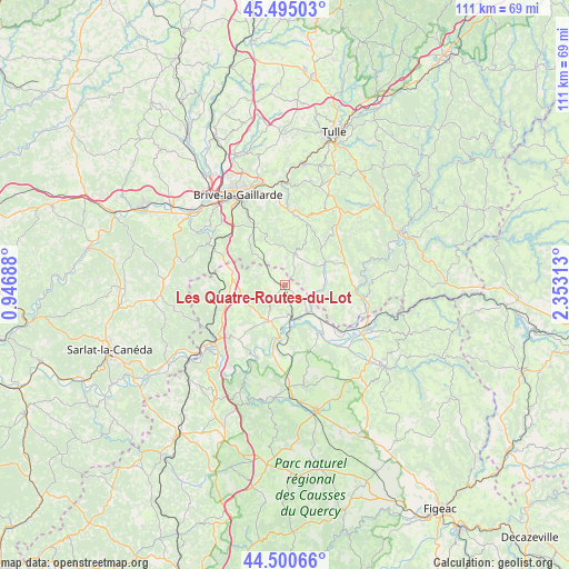
Les Quatre-Routes-du-Lot GPS coordinates[2]
45° 0' 0" North, 1° 39' 0" East
| Map corner | latitude | longitude |
|---|---|---|
| Upper-left | 45.49503°, | 0.94688° |
| Center: | 45°, | 1.65° |
| Lower-right: | 44.50066°, | 2.35313° |
| Map W x H: | 110.6×110.6 km | = 68.7×68.7mi |
| max Lat: | 51.07786° ⇑79.6% North |
| Les Quatre-Routes-du-Lot: | 45° |
| min Lat: | ⇓20.4% South 41.3874° |
| min Long | Les Quatre-Rout | max Long |
| -5.08615° | 1.65° | 9.52242° |
| W 39%⇐ | ⇒61% E |
Elevation
Elevation of Les Quatre-Routes-du-Lot is 124 m = 407 ft, and this is 69.7 m = 229 ft below average elevation for this country.
| Max E: |
2333 m = 7654 ft | 52.3% |
| Avg. | 193.7 m = 635 ft | |
| Les Quatre-Routes-du-Lot | 124 m = 407 ft | |
Min E: |
-1 m = -3 ft | 47.7% |
See also: France elevation on elevation.city.
Geographical zone
Les Quatre-Routes-du-Lot is located in North temperate zone (between Tropic of Cancer and the Arctic Circle). Distance of this Northern Tropic circle is 2397.6 km =1489.8 mi to South.| Distance of | km | miles | from Les Quatre-Routes-du-Lot |
|---|---|---|---|
| North Pole | 5003.5 | 3109 | to North |
| Arctic Circle | 2397.6 | 1489.8 | to North |
| Tropic Cancer | 2397.6 | 1489.8 | to South |
| Equator | 5003.5 | 3109 | to South |


Nearby cities:
15 places around Les Quatre-Routes-du-Lot: (largest is in red/bold)
• Beaulieu-sur-Dordogne
15 km =9.3 mi,  99°
99°
• Beynat
15 km =9.3 mi,  22°
22°
• Bétaille
9.1 km =5.7 mi,  133°
133°
• Cressensac
10.5 km =6.5 mi,  283°
283°
• Gignac
15.1 km =9.4 mi,  272°
272°
• Jugeals-Nazareth
11.5 km =7.1 mi,  321°
321°
• Lachapelle-Auzac
14.7 km =9.1 mi,  237°
237°
• Martel
7.8 km =4.8 mi,  204°
204°
• Meyssac
6.5 km =4 mi, 17°
• Nespouls
12.9 km =8 mi,  295°
295°
• Noailles
15.2 km =9.4 mi, 318°
• Puybrun
14.1 km =8.8 mi, 129°
• Sarrazac
5.1 km =3.2 mi,  291°
291°
• Turenne
8 km =5 mi, 318°
• Vayrac
6.7 km =4.2 mi,  140°
140°
Sources, notices
• [Note1] Compared only with cities in France existing in our database
• [Src1] Map data: © OpenStreetMap contributors (CC-BY-SA)
• [Src2] Other city data from geonames.org with taken over terms of usage.
• [Src3] Geographical zone / Annual Mean Temperature by Robert A. Rohde @ Wikipedia
