Grand-Fougeray geodata
Grand-Fougeray (Brittany) is a populated place; located in France in Europe/Paris (GMT+2) time zone. With population of 2,156 people, there are 4461 cities with bigger population in this country. Compared to other cities in France, 54.6% of cities are located further ↓South; 93.7% of cities are located further →East and 77.3% of cities have higher elevation than Grand-Fougeray. Note1
Administrative division(s):
- Level 1: Brittany
- Level 2: Département d'Ille-et-Vilaine
- Level 3: Arrondissement de Redon
- Level 4: Grand-Fougeray


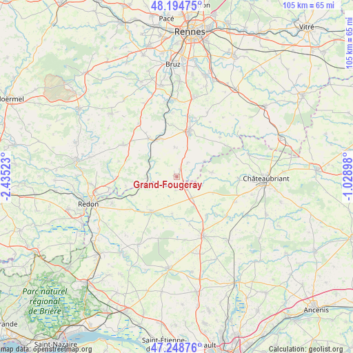
Grand-Fougeray GPS coordinates[2]
47° 43' 26.04" North, 1° 43' 55.56" West
| Map corner | latitude | longitude |
|---|---|---|
| Upper-left | 48.19475°, | -2.43523° |
| Center: | 47.7239°, | -1.7321° |
| Lower-right: | 47.24876°, | -1.02898° |
| Map W x H: | 105.2×105.2 km | = 65.4×65.4mi |
| max Lat: | 51.07786° ⇑45.4% North |
| Grand-Fougeray: | 47.7239° |
| min Lat: | ⇓54.6% South 41.3874° |
| min Long | Grand-Fougeray | max Long |
| -5.08615° | -1.7321° | 9.52242° |
| W 6.3%⇐ | ⇒93.7% E |
Elevation
Elevation of Grand-Fougeray is 61 m = 200 ft, and this is 132.7 m = 435 ft below average elevation for this country.
| Max E: |
2333 m = 7654 ft | 77.3% |
| Avg. | 193.7 m = 635 ft | |
| Grand-Fougeray | 61 m = 200 ft | |
Min E: |
-1 m = -3 ft | 22.7% |
See also: France elevation on elevation.city.
Geographical zone
Grand-Fougeray is located in North temperate zone (between Tropic of Cancer and the Arctic Circle). Distance of this North polar circle is 2094.8 km =1301.6 mi to North.| Distance of | km | miles | from Grand-Fougeray |
|---|---|---|---|
| North Pole | 4700.7 | 2920.9 | to North |
| Arctic Circle | 2094.8 | 1301.6 | to North |
| Tropic Cancer | 2700.5 | 1678 | to South |
| Equator | 5306.4 | 3297.2 | to South |


Nearby cities:
15 places around Grand-Fougeray: (largest is in red/bold)
• Bain-de-Bretagne
13.8 km =8.6 mi,  14°
14°
• Conquereuil
11.1 km =6.9 mi,  187°
187°
• Derval
7.8 km =4.8 mi,  143°
143°
• Guipry
14.1 km =8.8 mi,  324°
324°
• Guémené-Penfao
12.6 km =7.8 mi,  216°
216°
• Jans
14.5 km =9 mi, 142°
• La Dominelais
5.4 km =3.4 mi,  37°
37°
• La Noë-Blanche
8.9 km =5.5 mi,  355°
355°
• Langon
8.8 km =5.5 mi,  267°
267°
• Lusanger
11.7 km =7.3 mi,  113°
113°
• Marsac-sur-Don
14.7 km =9.1 mi,  164°
164°
• Messac
12.6 km =7.8 mi,  332°
332°
• Pierric
4.1 km =2.5 mi,  183°
183°
• Sainte-Anne-sur-Vilaine
7 km =4.3 mi,  275°
275°
• Sion-les-Mines
10.6 km =6.6 mi,  83°
83°
Sources, notices
• [Note1] Compared only with cities in France existing in our database
• [Src1] Map data: © OpenStreetMap contributors (CC-BY-SA)
• [Src2] Other city data from geonames.org with taken over terms of usage.
• [Src3] Geographical zone / Annual Mean Temperature by Robert A. Rohde @ Wikipedia
