Bellenaves geodata
Bellenaves (Auvergne-Rhône-Alpes) is a populated place; located in France in Europe/Paris (GMT+2) time zone. With population of 1,027 people, there are 8636 cities with bigger population in this country. Compared to other cities in France, 63.6% of cities are located further ↑North; 59% of cities are located further ←West and 82.8% of cities have lower elevation than Bellenaves. Note1
Administrative division(s):
- Level 1: Auvergne-Rhône-Alpes
- Level 2: Département de l'Allier
- Level 3: Arrondissement de Vichy
- Level 4: Bellenaves


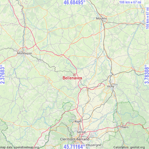
Bellenaves GPS coordinates[2]
46° 12' 1.62" North, 3° 4' 47.82" East
| Map corner | latitude | longitude |
|---|---|---|
| Upper-left | 46.68495°, | 2.37683° |
| Center: | 46.20045°, | 3.07995° |
| Lower-right: | 45.71164°, | 3.78308° |
| Map W x H: | 108.2×108.2 km | = 67.2×67.2mi |
| max Lat: | 51.07786° ⇑63.6% North |
| Bellenaves: | 46.20045° |
| min Lat: | ⇓36.4% South 41.3874° |
| min Long | Bellenaves | max Long |
| -5.08615° | 3.07995° | 9.52242° |
| W 59%⇐ | ⇒41% E |
Elevation
Elevation of Bellenaves is 320 m = 1050 ft, and this is 126.3 m = 414 ft above average elevation for this country.
| Max E: |
2333 m = 7654 ft | 17.2% |
| Bellenaves | 320 m 1050 ft | |
| Avg. | 193.7 m = 635 ft | |
Min E: |
-1 m = -3 ft | 82.8% |
See also: France elevation on elevation.city.
Geographical zone
Bellenaves is located in North temperate zone (between Tropic of Cancer and the Arctic Circle). Distance of this North polar circle is 2264.2 km =1406.9 mi to North.| Distance of | km | miles | from Bellenaves |
|---|---|---|---|
| North Pole | 4870.1 | 3026.1 | to North |
| Arctic Circle | 2264.2 | 1406.9 | to North |
| Tropic Cancer | 2531.1 | 1572.8 | to South |
| Equator | 5137 | 3192 | to South |


Nearby cities:
15 places around Bellenaves: (largest is in red/bold)
• Bayet
15.5 km =9.6 mi,  69°
69°
• Bransat
17.7 km =11 mi,  40°
40°
• Broût-Vernet
14.9 km =9.3 mi,  95°
95°
• Chantelle
7 km =4.3 mi,  53°
53°
• Escurolles
15.6 km =9.7 mi,  114°
114°
• Gannat
14.4 km =8.9 mi,  140°
140°
• Lapeyrouse
16.2 km =10.1 mi,  279°
279°
• Menat
17.3 km =10.7 mi,  231°
231°
• Montmarault
16.2 km =10.1 mi,  323°
323°
• Saint-Bonnet-de-Rochefort
7.5 km =4.7 mi, 143°
• Saint-Éloy-les-Mines
19.5 km =12.1 mi,  256°
256°
• Saulcet
19.7 km =12.2 mi, 45°
• Servant
13.5 km =8.4 mi,  239°
239°
• Ébreuil
9.5 km =5.9 mi,  176°
176°
• Étroussat
11 km =6.8 mi,  79°
79°
Sources, notices
• [Note1] Compared only with cities in France existing in our database
• [Src1] Map data: © OpenStreetMap contributors (CC-BY-SA)
• [Src2] Other city data from geonames.org with taken over terms of usage.
• [Src3] Geographical zone / Annual Mean Temperature by Robert A. Rohde @ Wikipedia
