Gennes-sur-Glaize geodata
Gennes-sur-Glaize (Pays de la Loire) is a populated place; located in France in Europe/Paris (GMT+2) time zone. With population of 827 people, there are 10320 cities with bigger population in this country. Compared to other cities in France, 56.7% of cities are located further ↓South; 84.6% of cities are located further →East and 74.1% of cities have higher elevation than Gennes-sur-Glaize. Note1
Administrative division(s):
- Level 1: Pays de la Loire
- Level 2: Mayenne
- Level 3: Arrondissement de Château-Gontier
- Level 4: Gennes-Longuefuye


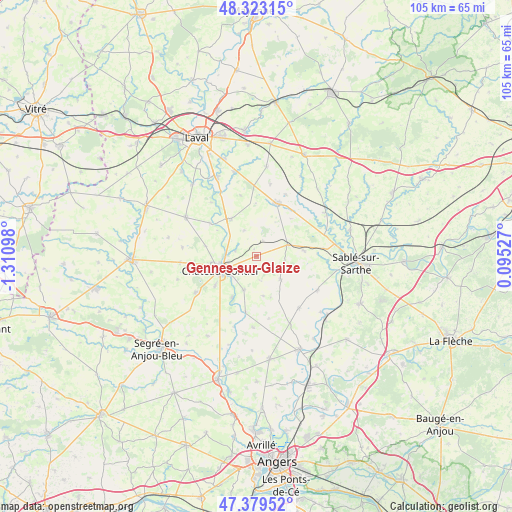
Gennes-sur-Glaize GPS coordinates[2]
47° 51' 12.528" North, 0° 36' 28.26" West
| Map corner | latitude | longitude |
|---|---|---|
| Upper-left | 48.32315°, | -1.31098° |
| Center: | 47.85348°, | -0.60785° |
| Lower-right: | 47.37952°, | 0.09527° |
| Map W x H: | 104.9×104.9 km | = 65.2×65.2mi |
| max Lat: | 51.07786° ⇑43.3% North |
| Gennes-sur-Glaize: | 47.85348° |
| min Lat: | ⇓56.7% South 41.3874° |
| min Long | Gennes-sur-Glai | max Long |
| -5.08615° | -0.60785° | 9.52242° |
| W 15.4%⇐ | ⇒84.6% E |
Elevation
Elevation of Gennes-sur-Glaize is 69 m = 226 ft, and this is 124.7 m = 409 ft below average elevation for this country.
| Max E: |
2333 m = 7654 ft | 74.1% |
| Avg. | 193.7 m = 635 ft | |
| Gennes-sur-Glaize | 69 m = 226 ft | |
Min E: |
-1 m = -3 ft | 25.9% |
See also: France elevation on elevation.city.
Geographical zone
Gennes-sur-Glaize is located in North temperate zone (between Tropic of Cancer and the Arctic Circle). Distance of this North polar circle is 2080.4 km =1292.7 mi to North.| Distance of | km | miles | from Gennes-sur-Glaize |
|---|---|---|---|
| North Pole | 4686.3 | 2911.9 | to North |
| Arctic Circle | 2080.4 | 1292.7 | to North |
| Tropic Cancer | 2714.9 | 1687 | to South |
| Equator | 5320.8 | 3306.2 | to South |


Nearby cities:
15 places around Gennes-sur-Glaize: (largest is in red/bold)
• Azé
6.6 km =4.1 mi,  238°
238°
• Bierné
6.7 km =4.2 mi,  134°
134°
• Bouère
9.8 km =6.1 mi,  83°
83°
• Chemazé
14.5 km =9 mi, 239°
• Château-Gontier
7.6 km =4.7 mi,  248°
248°
• Coudray
7.4 km =4.6 mi,  201°
201°
• Fromentières
4.6 km =2.9 mi,  285°
285°
• Grez-en-Bouère
6.7 km =4.2 mi,  70°
70°
• Loigné-sur-Mayenne
10.7 km =6.6 mi,  281°
281°
• Marigné
14.6 km =9.1 mi,  183°
183°
• Meslay-du-Maine
11.6 km =7.2 mi,  20°
20°
• Miré
13.8 km =8.6 mi,  140°
140°
• Ménil
10 km =6.2 mi,  211°
211°
• Saint-Fort
10.4 km =6.5 mi,  234°
234°
• Villiers-Charlemagne
9.1 km =5.7 mi,  326°
326°
Sources, notices
• [Note1] Compared only with cities in France existing in our database
• [Src1] Map data: © OpenStreetMap contributors (CC-BY-SA)
• [Src2] Other city data from geonames.org with taken over terms of usage.
• [Src3] Geographical zone / Annual Mean Temperature by Robert A. Rohde @ Wikipedia
