Le Merlerault geodata
Le Merlerault (Normandy) is a populated place; located in France in Europe/Paris (GMT+2) time zone. With population of 983 people, there are 8958 cities with bigger population in this country. Compared to other cities in France, 73.3% of cities are located further ↓South; 75.5% of cities are located further →East and 68% of cities have lower elevation than Le Merlerault. Note1
Administrative division(s):
- Level 1: Normandy
- Level 2: Département de l'Orne
- Level 3: Arrondissement de Mortagne-au-Perche
- Level 4: Le Merlerault


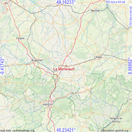
Le Merlerault GPS coordinates[2]
48° 42' 1.476" North, 0° 17' 8.52" East
| Map corner | latitude | longitude |
|---|---|---|
| Upper-left | 49.16233°, | -0.41743° |
| Center: | 48.70041°, | 0.2857° |
| Lower-right: | 48.23421°, | 0.98882° |
| Map W x H: | 103.2×103.2 km | = 64.1×64.1mi |
| max Lat: | 51.07786° ⇑26.7% North |
| Le Merlerault: | 48.70041° |
| min Lat: | ⇓73.3% South 41.3874° |
| min Long | Le Merlerault | max Long |
| -5.08615° | 0.2857° | 9.52242° |
| W 24.5%⇐ | ⇒75.5% E |
Elevation
Elevation of Le Merlerault is 209 m = 686 ft, and this is 15.3 m = 50 ft above average elevation for this country.
| Max E: |
2333 m = 7654 ft | 32% |
| Le Merlerault | 209 m 686 ft | |
| Avg. | 193.7 m = 635 ft | |
Min E: |
-1 m = -3 ft | 68% |
See also: France elevation on elevation.city.
Geographical zone
Le Merlerault is located in North temperate zone (between Tropic of Cancer and the Arctic Circle). Distance of this North polar circle is 1986.2 km =1234.2 mi to North.| Distance of | km | miles | from Le Merlerault |
|---|---|---|---|
| North Pole | 4592.1 | 2853.4 | to North |
| Arctic Circle | 1986.2 | 1234.2 | to North |
| Tropic Cancer | 2809.1 | 1745.5 | to South |
| Equator | 5415 | 3364.7 | to South |


Nearby cities:
15 places around Le Merlerault: (largest is in red/bold)
• Almenêches
12.9 km =8 mi,  268°
268°
• Aube-sur-Rîle
20 km =12.4 mi,  77°
77°
• Courtomer
9.6 km =6 mi,  147°
147°
• Essay
17.9 km =11.1 mi,  189°
189°
• Gacé
10.4 km =6.5 mi,  4°
4°
• Le Mêle-sur-Sarthe
21.5 km =13.4 mi,  166°
166°
• Mortrée
16.6 km =10.3 mi,  245°
245°
• Moulins-la-Marche
15 km =9.3 mi,  111°
111°
• Nonant-le-Pin
4.8 km =3 mi,  277°
277°
• Sainte-Gauburge-Sainte-Colombe
10.8 km =6.7 mi, 80°
• Sainte-Scolasse-sur-Sarthe
15.9 km =9.9 mi, 150°
• Soligny-la-Trappe
20.7 km =12.9 mi,  117°
117°
• Sées
13.6 km =8.5 mi,  217°
217°
• Urou-et-Crennes
20.5 km =12.7 mi,  286°
286°
• Échauffour
8.7 km =5.4 mi,  59°
59°
Sources, notices
• [Note1] Compared only with cities in France existing in our database
• [Src1] Map data: © OpenStreetMap contributors (CC-BY-SA)
• [Src2] Other city data from geonames.org with taken over terms of usage.
• [Src3] Geographical zone / Annual Mean Temperature by Robert A. Rohde @ Wikipedia
