Pont-de-Salars geodata
Pont-de-Salars (Occitanie) is a populated place; located in France in Europe/Paris (GMT+2) time zone. With population of 1,515 people, there are 6141 cities with bigger population in this country. Compared to other cities in France, 85% of cities are located further ↑North; 53.9% of cities are located further ←West and 96.8% of cities have lower elevation than Pont-de-Salars. Note1
Administrative division(s):
- Level 1: Occitanie
- Level 2: Département de l'Aveyron
- Level 3: Arrondissement de Millau
- Level 4: Pont-de-Salars


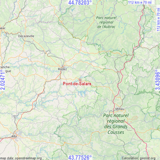
Pont-de-Salars GPS coordinates[2]
44° 16' 50.88" North, 2° 43' 40.188" East
| Map corner | latitude | longitude |
|---|---|---|
| Upper-left | 44.78203°, | 2.02471° |
| Center: | 44.2808°, | 2.72783° |
| Lower-right: | 43.77526°, | 3.43096° |
| Map W x H: | 111.9×111.9 km | = 69.5×69.5mi |
| max Lat: | 51.07786° ⇑85% North |
| Pont-de-Salars: | 44.2808° |
| min Lat: | ⇓15% South 41.3874° |
| min Long | Pont-de-Salars | max Long |
| -5.08615° | 2.72783° | 9.52242° |
| W 53.9%⇐ | ⇒46.1% E |
Elevation
Elevation of Pont-de-Salars is 707 m = 2320 ft, and this is 513.3 m = 1684 ft above average elevation for this country.
| Max E: |
2333 m = 7654 ft | 3.2% |
| Pont-de-Salars | 707 m 2320 ft | |
| Avg. | 193.7 m = 635 ft | |
Min E: |
-1 m = -3 ft | 96.8% |
See also: France elevation on elevation.city.
Geographical zone
Pont-de-Salars is located in North temperate zone (between Tropic of Cancer and the Arctic Circle). Distance of this Northern Tropic circle is 2317.6 km =1440.1 mi to South.| Distance of | km | miles | from Pont-de-Salars |
|---|---|---|---|
| North Pole | 5083.5 | 3158.7 | to North |
| Arctic Circle | 2477.6 | 1539.5 | to North |
| Tropic Cancer | 2317.6 | 1440.1 | to South |
| Equator | 4923.6 | 3059.4 | to South |


Nearby cities:
15 places around Pont-de-Salars: (largest is in red/bold)
• Arvieu
11.2 km =7 mi,  208°
208°
• Bertholène
13.4 km =8.3 mi,  18°
18°
• Flavin
9.8 km =6.1 mi,  275°
275°
• La Loubière
11.1 km =6.9 mi,  334°
334°
• Laissac
13.4 km =8.3 mi,  33°
33°
• Le Monastère
13.6 km =8.5 mi,  299°
299°
• Luc-la-Primaube
15.8 km =9.8 mi, 283°
• Olemps
15.8 km =9.8 mi, 297°
• Rodez
14.7 km =9.1 mi, 303°
• Sainte-Radegonde
10.2 km =6.3 mi,  308°
308°
• Salles-Curan
12 km =7.5 mi,  156°
156°
• Salmiech
16.5 km =10.3 mi,  228°
228°
• Sébazac-Concourès
17 km =10.6 mi,  324°
324°
• Ségur
8.6 km =5.3 mi,  81°
81°
• Trémouilles
7.8 km =4.8 mi,  238°
238°
Sources, notices
• [Note1] Compared only with cities in France existing in our database
• [Src1] Map data: © OpenStreetMap contributors (CC-BY-SA)
• [Src2] Other city data from geonames.org with taken over terms of usage.
• [Src3] Geographical zone / Annual Mean Temperature by Robert A. Rohde @ Wikipedia
