La Ferté-Macé geodata
La Ferté-Macé (Normandy) is a populated place; located in France in Europe/Paris (GMT+2) time zone. With population of 7,372 people, there are 1328 cities with bigger population in this country. Compared to other cities in France, 70.6% of cities are located further ↓South; 81.5% of cities are located further →East and 70.6% of cities have lower elevation than La Ferté-Macé. Note1
Administrative division(s):
- Level 1: Normandy
- Level 2: Département de l'Orne
- Level 3: Argentan
- Level 4: La Ferté Macé


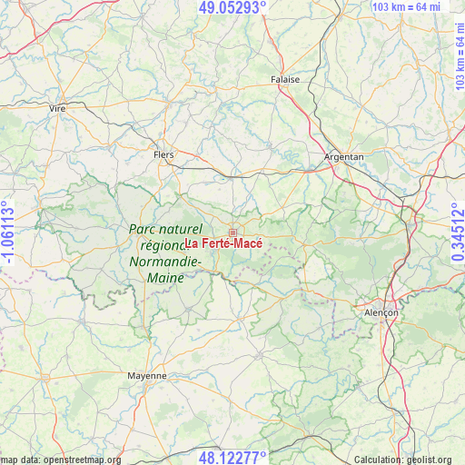
La Ferté-Macé GPS coordinates[2]
48° 35' 23.964" North, 0° 21' 28.8" West
| Map corner | latitude | longitude |
|---|---|---|
| Upper-left | 49.05293°, | -1.06113° |
| Center: | 48.58999°, | -0.358° |
| Lower-right: | 48.12277°, | 0.34512° |
| Map W x H: | 103.4×103.4 km | = 64.2×64.2mi |
| max Lat: | 51.07786° ⇑29.4% North |
| La Ferté-Macé: | 48.58999° |
| min Lat: | ⇓70.6% South 41.3874° |
| min Long | La Ferté-Macé | max Long |
| -5.08615° | -0.358° | 9.52242° |
| W 18.5%⇐ | ⇒81.5% E |
Elevation
Elevation of La Ferté-Macé is 222 m = 728 ft, and this is 28.3 m = 93 ft above average elevation for this country.
| Max E: |
2333 m = 7654 ft | 29.4% |
| La Ferté-Macé | 222 m 728 ft | |
| Avg. | 193.7 m = 635 ft | |
Min E: |
-1 m = -3 ft | 70.6% |
See also: France elevation on elevation.city.
Geographical zone
La Ferté-Macé is located in North temperate zone (between Tropic of Cancer and the Arctic Circle). Distance of this North polar circle is 1998.5 km =1241.8 mi to North.| Distance of | km | miles | from La Ferté-Macé |
|---|---|---|---|
| North Pole | 4604.4 | 2861 | to North |
| Arctic Circle | 1998.5 | 1241.8 | to North |
| Tropic Cancer | 2796.8 | 1737.9 | to South |
| Equator | 5402.7 | 3357.1 | to South |


Nearby cities:
15 places around La Ferté-Macé: (largest is in red/bold)
• Bagnoles-de-l'Orne
5.5 km =3.4 mi,  228°
228°
• Bellou-en-Houlme
12.7 km =7.9 mi,  331°
331°
• Briouze
12.1 km =7.5 mi,  356°
356°
• Carrouges
15.8 km =9.8 mi,  99°
99°
• Champsecret
14.3 km =8.9 mi,  278°
278°
• Couterne
9.5 km =5.9 mi,  206°
206°
• Juvigny-sous-Andaine
11.9 km =7.4 mi,  249°
249°
• La Coulonche
9.6 km =6 mi,  311°
311°
• La Ferrière-aux-Étangs
14.3 km =8.9 mi,  304°
304°
• La Sauvagère
5.7 km =3.5 mi, 310°
• Lignières-Orgères
12.3 km =7.6 mi,  115°
115°
• Magny-le-Désert
3.2 km =2 mi,  134°
134°
• Rânes
12.2 km =7.6 mi,  62°
62°
• Saint-Maurice-du-Désert
3.2 km =2 mi,  315°
315°
• Tessé-la-Madeleine
6.7 km =4.2 mi, 227°
Sources, notices
• [Note1] Compared only with cities in France existing in our database
• [Src1] Map data: © OpenStreetMap contributors (CC-BY-SA)
• [Src2] Other city data from geonames.org with taken over terms of usage.
• [Src3] Geographical zone / Annual Mean Temperature by Robert A. Rohde @ Wikipedia
