Labessière-Candeil geodata
Labessière-Candeil (Occitanie) is a populated place; located in France in Europe/Paris (GMT+2) time zone. With population of 712 people, there are 11628 cities with bigger population in this country. Compared to other cities in France, 89.1% of cities are located further ↑North; 57.1% of cities are located further →East and 77.3% of cities have lower elevation than Labessière-Candeil. Note1
Administrative division(s):
- Level 1: Occitanie
- Level 2: Tarn
- Level 3: Albi
- Level 4: Labessière-Candeil


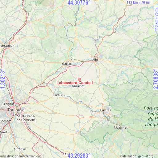
Labessière-Candeil GPS coordinates[2]
43° 48' 8.82" North, 2° 0' 18.936" East
| Map corner | latitude | longitude |
|---|---|---|
| Upper-left | 44.30776°, | 1.30213° |
| Center: | 43.80245°, | 2.00526° |
| Lower-right: | 43.29283°, | 2.70838° |
| Map W x H: | 112.8×112.8 km | = 70.1×70.1mi |
| max Lat: | 51.07786° ⇑89.1% North |
| Labessière-Candeil: | 43.80245° |
| min Lat: | ⇓10.9% South 41.3874° |
| min Long | Labessière-Can | max Long |
| -5.08615° | 2.00526° | 9.52242° |
| W 42.9%⇐ | ⇒57.1% E |
Elevation
Elevation of Labessière-Candeil is 266 m = 873 ft, and this is 72.3 m = 237 ft above average elevation for this country.
| Max E: |
2333 m = 7654 ft | 22.7% |
| Labessière-Candeil | 266 m 873 ft | |
| Avg. | 193.7 m = 635 ft | |
Min E: |
-1 m = -3 ft | 77.3% |
See also: France elevation on elevation.city.
Geographical zone
Labessière-Candeil is located in North temperate zone (between Tropic of Cancer and the Arctic Circle). Distance of this Northern Tropic circle is 2264.5 km =1407.1 mi to South.| Distance of | km | miles | from Labessière-Candeil |
|---|---|---|---|
| North Pole | 5136.7 | 3191.8 | to North |
| Arctic Circle | 2530.8 | 1572.6 | to North |
| Tropic Cancer | 2264.5 | 1407.1 | to South |
| Equator | 4870.4 | 3026.3 | to South |


Nearby cities:
15 places around Labessière-Candeil: (largest is in red/bold)
• Brens
12.3 km =7.6 mi,  320°
320°
• Briatexte
9.5 km =5.9 mi,  234°
234°
• Busque
4.3 km =2.7 mi,  238°
238°
• Cadalen
5.6 km =3.5 mi,  339°
339°
• Carlus
12.6 km =7.8 mi,  41°
41°
• Florentin
9.8 km =6.1 mi,  13°
13°
• Graulhet
4.2 km =2.6 mi,  197°
197°
• Lagrave
10.6 km =6.6 mi,  354°
354°
• Lombers
11.6 km =7.2 mi,  91°
91°
• Marssac-sur-Tarn
13 km =8.1 mi, 8°
• Montans
12 km =7.5 mi,  306°
306°
• Rivières
12.8 km =8 mi, 344°
• Rouffiac
10.3 km =6.4 mi,  29°
29°
• Saint-Gauzens
10.5 km =6.5 mi, 234°
• Técou
6.4 km =4 mi, 315°
Sources, notices
• [Note1] Compared only with cities in France existing in our database
• [Src1] Map data: © OpenStreetMap contributors (CC-BY-SA)
• [Src2] Other city data from geonames.org with taken over terms of usage.
• [Src3] Geographical zone / Annual Mean Temperature by Robert A. Rohde @ Wikipedia
