Ispagnac geodata
Ispagnac (Occitanie) is a populated place; located in France in Europe/Paris (GMT+2) time zone. With population of 815 people, there are 10429 cities with bigger population in this country. Compared to other cities in France, 84.4% of cities are located further ↑North; 64.6% of cities are located further ←West and 93.7% of cities have lower elevation than Ispagnac. Note1
Administrative division(s):
- Level 1: Occitanie
- Level 2: Département de la Lozère
- Level 3: Arrondissement de Florac
- Level 4: Ispagnac


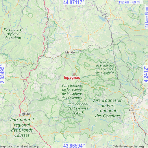
Ispagnac GPS coordinates[2]
44° 22' 14.556" North, 3° 32' 17.052" East
| Map corner | latitude | longitude |
|---|---|---|
| Upper-left | 44.87117°, | 2.83495° |
| Center: | 44.37071°, | 3.53807° |
| Lower-right: | 43.86594°, | 4.2412° |
| Map W x H: | 111.8×111.8 km | = 69.5×69.5mi |
| max Lat: | 51.07786° ⇑84.4% North |
| Ispagnac: | 44.37071° |
| min Lat: | ⇓15.6% South 41.3874° |
| min Long | Ispagnac | max Long |
| -5.08615° | 3.53807° | 9.52242° |
| W 64.6%⇐ | ⇒35.4% E |
Elevation
Elevation of Ispagnac is 530 m = 1739 ft, and this is 336.3 m = 1103 ft above average elevation for this country.
| Max E: |
2333 m = 7654 ft | 6.3% |
| Ispagnac | 530 m 1739 ft | |
| Avg. | 193.7 m = 635 ft | |
Min E: |
-1 m = -3 ft | 93.7% |
See also: France elevation on elevation.city.
Geographical zone
Ispagnac is located in North temperate zone (between Tropic of Cancer and the Arctic Circle). Distance of this Northern Tropic circle is 2327.6 km =1446.3 mi to South.| Distance of | km | miles | from Ispagnac |
|---|---|---|---|
| North Pole | 5073.5 | 3152.5 | to North |
| Arctic Circle | 2467.6 | 1533.3 | to North |
| Tropic Cancer | 2327.6 | 1446.3 | to South |
| Equator | 4933.6 | 3065.6 | to South |


Nearby cities:
15 places around Ispagnac: (largest is in red/bold)
• Badaroux
18.2 km =11.3 mi,  2°
2°
• Balsièges
13.8 km =8.6 mi,  332°
332°
• Banassac
27.9 km =17.3 mi,  285°
285°
• Barjac
17.8 km =11.1 mi, 325°
• Chanac
18.8 km =11.7 mi,  304°
304°
• Chastel-Nouvel
21.1 km =13.1 mi,  352°
352°
• Chirac
27.4 km =17 mi,  308°
308°
• Florac
6.6 km =4.1 mi,  138°
138°
• La Canourgue
26.5 km =16.5 mi,  284°
284°
• Le Monastier-Pin-Moriès
28 km =17.4 mi, 305°
• Mende
16.7 km =10.4 mi, 350°
• Meyrueis
23.1 km =14.4 mi,  201°
201°
• Montrodat
26 km =16.2 mi,  320°
320°
• Saint-Étienne-du-Valdonnez
9.7 km =6 mi,  11°
11°
• Sainte-Enimie
9.7 km =6 mi,  267°
267°
Sources, notices
• [Note1] Compared only with cities in France existing in our database
• [Src1] Map data: © OpenStreetMap contributors (CC-BY-SA)
• [Src2] Other city data from geonames.org with taken over terms of usage.
• [Src3] Geographical zone / Annual Mean Temperature by Robert A. Rohde @ Wikipedia
