Balsièges geodata
Balsièges (Occitanie) is a populated place; located in France in Europe/Paris (GMT+2) time zone. With population of 546 people, there are 14284 cities with bigger population in this country. Compared to other cities in France, 83.7% of cities are located further ↑North; 63.8% of cities are located further ←West and 96.5% of cities have lower elevation than Balsièges. Note1
Administrative division(s):
- Level 1: Occitanie
- Level 2: Département de la Lozère
- Level 3: Arrondissement de Mende
- Level 4: Balsièges


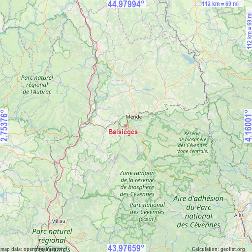
Balsièges GPS coordinates[2]
44° 28' 49.512" North, 3° 27' 24.768" East
| Map corner | latitude | longitude |
|---|---|---|
| Upper-left | 44.97994°, | 2.75376° |
| Center: | 44.48042°, | 3.45688° |
| Lower-right: | 43.97659°, | 4.16001° |
| Map W x H: | 111.6×111.6 km | = 69.3×69.3mi |
| max Lat: | 51.07786° ⇑83.7% North |
| Balsièges: | 44.48042° |
| min Lat: | ⇓16.3% South 41.3874° |
| min Long | Balsièges | max Long |
| -5.08615° | 3.45688° | 9.52242° |
| W 63.8%⇐ | ⇒36.2% E |
Elevation
Elevation of Balsièges is 682 m = 2238 ft, and this is 488.3 m = 1602 ft above average elevation for this country.
| Max E: |
2333 m = 7654 ft | 3.5% |
| Balsièges | 682 m 2238 ft | |
| Avg. | 193.7 m = 635 ft | |
Min E: |
-1 m = -3 ft | 96.5% |
See also: France elevation on elevation.city.
Geographical zone
Balsièges is located in North temperate zone (between Tropic of Cancer and the Arctic Circle). Distance of this Northern Tropic circle is 2339.8 km =1453.9 mi to South.| Distance of | km | miles | from Balsièges |
|---|---|---|---|
| North Pole | 5061.3 | 3144.9 | to North |
| Arctic Circle | 2455.4 | 1525.7 | to North |
| Tropic Cancer | 2339.8 | 1453.9 | to South |
| Equator | 4945.8 | 3073.2 | to South |


Nearby cities:
15 places around Balsièges: (largest is in red/bold)
• Badaroux
9.3 km =5.8 mi,  50°
50°
• Barjac
4.4 km =2.7 mi,  304°
304°
• Chanac
9.2 km =5.7 mi,  260°
260°
• Chastel-Nouvel
9.4 km =5.8 mi,  21°
21°
• Chirac
15.8 km =9.8 mi,  287°
287°
• Florac
20.3 km =12.6 mi,  147°
147°
• Ispagnac
13.8 km =8.6 mi, 152°
• La Canourgue
19.9 km =12.4 mi,  254°
254°
• Le Monastier-Pin-Moriès
16.9 km =10.5 mi,  283°
283°
• Marvejols
15.5 km =9.6 mi, 301°
• Mende
5.6 km =3.5 mi,  41°
41°
• Montrodat
12.8 km =8 mi,  307°
307°
• Rieutort-de-Randon
17.1 km =10.6 mi,  7°
7°
• Saint-Étienne-du-Valdonnez
8.9 km =5.5 mi,  107°
107°
• Sainte-Enimie
13 km =8.1 mi,  194°
194°
Sources, notices
• [Note1] Compared only with cities in France existing in our database
• [Src1] Map data: © OpenStreetMap contributors (CC-BY-SA)
• [Src2] Other city data from geonames.org with taken over terms of usage.
• [Src3] Geographical zone / Annual Mean Temperature by Robert A. Rohde @ Wikipedia
