Lesquielles-Saint-Germain geodata
Lesquielles-Saint-Germain (Hauts-de-France) is a populated place; located in France in Europe/Paris (GMT+2) time zone. With population of 850 people, there are 10081 cities with bigger population in this country. Compared to other cities in France, 93.2% of cities are located further ↓South; 65.2% of cities are located further ←West and 50.3% of cities have lower elevation than Lesquielles-Saint-Germain. Note1
Administrative division(s):
- Level 1: Hauts-de-France
- Level 2: Département de l'Aisne
- Level 3: Arrondissement de Vervins
- Level 4: Lesquielles-Saint-Germain
Current local time in Lesquielles-Saint-Germain:
05:56 AM, WednesdayDifference from your time zone: hours


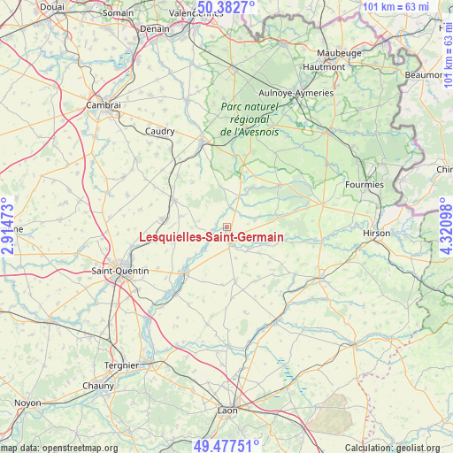
Lesquielles-Saint-Germain GPS coordinates[2]
49° 55' 56.028" North, 3° 37' 4.26" East
| Map corner | latitude | longitude |
|---|---|---|
| Upper-left | 50.3827°, | 2.91473° |
| Center: | 49.93223°, | 3.61785° |
| Lower-right: | 49.47751°, | 4.32098° |
| Map W x H: | 100.6×100.6 km | = 62.5×62.5mi |
| max Lat: | 51.07786° ⇑6.8% North |
| Lesquielles-Saint-Germain: | 49.93223° |
| min Lat: | ⇓93.2% South 41.3874° |
| min Long | Lesquielles-Sai | max Long |
| -5.08615° | 3.61785° | 9.52242° |
| W 65.2%⇐ | ⇒34.8% E |
Elevation
Elevation of Lesquielles-Saint-Germain is 133 m = 436 ft, and this is 60.7 m = 199 ft below average elevation for this country.
| Max E: |
2333 m = 7654 ft | 49.7% |
| Avg. | 193.7 m = 635 ft | |
| Lesquielles-Saint-Germain | 133 m = 436 ft | |
Min E: |
-1 m = -3 ft | 50.3% |
See also: France elevation on elevation.city.
Geographical zone
Lesquielles-Saint-Germain is located in North temperate zone (between Tropic of Cancer and the Arctic Circle). Distance of this North polar circle is 1849.2 km =1149 mi to North.| Distance of | km | miles | from Lesquielles-Saint-Germain |
|---|---|---|---|
| North Pole | 4455.1 | 2768.3 | to North |
| Arctic Circle | 1849.2 | 1149 | to North |
| Tropic Cancer | 2946 | 1830.6 | to South |
| Equator | 5551.9 | 3449.8 | to South |


Nearby cities:
15 places around Lesquielles-Saint-Germain: (largest is in red/bold)
• Bohain-en-Vermandois
13.3 km =8.3 mi,  297°
297°
• Boué
10.4 km =6.5 mi,  32°
32°
• Esquéhéries
10.9 km =6.8 mi,  58°
58°
• Fresnoy-le-Grand
14.4 km =8.9 mi,  276°
276°
• Guise
3.6 km =2.2 mi,  168°
168°
• Mennevret
7.5 km =4.7 mi,  323°
323°
• Origny-Sainte-Benoite
13.9 km =8.6 mi,  217°
217°
• Sains-Richaumont
13.8 km =8.6 mi,  151°
151°
• Saint-Souplet
15.1 km =9.4 mi,  335°
335°
• Seboncourt
10.4 km =6.5 mi, 282°
• Vadencourt
3.7 km =2.3 mi,  271°
271°
• Vaux-Andigny
12.4 km =7.7 mi, 324°
• Wassigny
9.1 km =5.7 mi,  351°
351°
• Étaves-et-Bocquiaux
11.6 km =7.2 mi, 273°
• Étreux
6.1 km =3.8 mi,  22°
22°
Sources, notices
• [Note1] Compared only with cities in France existing in our database
• [Src1] Map data: © OpenStreetMap contributors (CC-BY-SA)
• [Src2] Other city data from geonames.org with taken over terms of usage.
• [Src3] Geographical zone / Annual Mean Temperature by Robert A. Rohde @ Wikipedia
