Saint-Amans-des-Cots geodata
Saint-Amans-des-Cots (Occitanie) is a populated place; located in France in Europe/Paris (GMT+2) time zone. With population of 814 people, there are 10439 cities with bigger population in this country. Compared to other cities in France, 82.2% of cities are located further ↑North; 52.9% of cities are located further ←West and 97.1% of cities have lower elevation than Saint-Amans-des-Cots. Note1
Administrative division(s):
- Level 1: Occitanie
- Level 2: Département de l'Aveyron
- Level 3: Arrondissement de Rodez
- Level 4: Saint-Amans-des-Cots


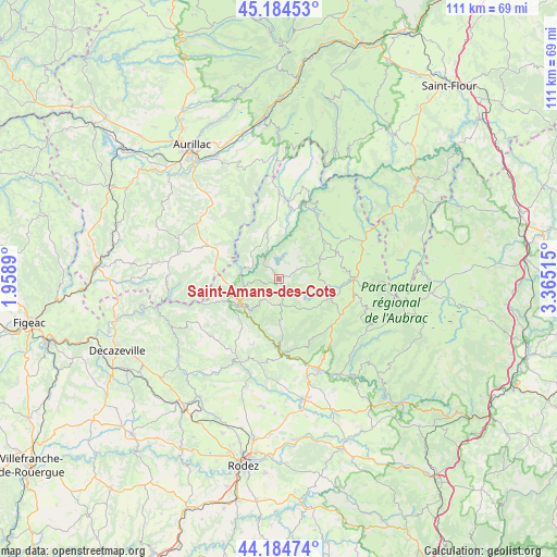
Saint-Amans-des-Cots GPS coordinates[2]
44° 41' 12.444" North, 2° 39' 43.272" East
| Map corner | latitude | longitude |
|---|---|---|
| Upper-left | 45.18453°, | 1.9589° |
| Center: | 44.68679°, | 2.66202° |
| Lower-right: | 44.18474°, | 3.36515° |
| Map W x H: | 111.2×111.2 km | = 69.1×69.1mi |
| max Lat: | 51.07786° ⇑82.2% North |
| Saint-Amans-des-Cots: | 44.68679° |
| min Lat: | ⇓17.8% South 41.3874° |
| min Long | Saint-Amans-des | max Long |
| -5.08615° | 2.66202° | 9.52242° |
| W 52.9%⇐ | ⇒47.1% E |
Elevation
Elevation of Saint-Amans-des-Cots is 729 m = 2392 ft, and this is 535.3 m = 1756 ft above average elevation for this country.
| Max E: |
2333 m = 7654 ft | 2.9% |
| Saint-Amans-des-Cots | 729 m 2392 ft | |
| Avg. | 193.7 m = 635 ft | |
Min E: |
-1 m = -3 ft | 97.1% |
See also: France elevation on elevation.city.
Geographical zone
Saint-Amans-des-Cots is located in North temperate zone (between Tropic of Cancer and the Arctic Circle). Distance of this Northern Tropic circle is 2362.8 km =1468.2 mi to South.| Distance of | km | miles | from Saint-Amans-des-Cots |
|---|---|---|---|
| North Pole | 5038.4 | 3130.7 | to North |
| Arctic Circle | 2432.5 | 1511.5 | to North |
| Tropic Cancer | 2362.8 | 1468.2 | to South |
| Equator | 4968.7 | 3087.4 | to South |


Nearby cities:
15 places around Saint-Amans-des-Cots: (largest is in red/bold)
• Brommat
15.9 km =9.9 mi,  6°
6°
• Coubisou
15.8 km =9.8 mi,  160°
160°
• Entraygues-sur-Truyère
8.7 km =5.4 mi,  238°
238°
• Espalion
19.9 km =12.4 mi, 156°
• Estaing
14.6 km =9.1 mi,  177°
177°
• Lacroix-Barrez
10.6 km =6.6 mi,  349°
349°
• Lafeuillade-en-Vézie
19.6 km =12.2 mi,  305°
305°
• Laguiole
14.6 km =9.1 mi,  90°
90°
• Le Nayrac
8.2 km =5.1 mi, 178°
• Montpeyroux
13.7 km =8.5 mi,  111°
111°
• Montsalvy
13 km =8.1 mi,  280°
280°
• Mur-de-Barrez
17.4 km =10.8 mi,  359°
359°
• Sainte-Geneviève-sur-Argence
15 km =9.3 mi,  30°
30°
• Sénergues
16.7 km =10.4 mi, 237°
• Taussac
15.9 km =9.9 mi, 354°
Sources, notices
• [Note1] Compared only with cities in France existing in our database
• [Src1] Map data: © OpenStreetMap contributors (CC-BY-SA)
• [Src2] Other city data from geonames.org with taken over terms of usage.
• [Src3] Geographical zone / Annual Mean Temperature by Robert A. Rohde @ Wikipedia
