Laguiole geodata
Laguiole (Occitanie) is a populated place; located in France in Europe/Paris (GMT+2) time zone. With population of 1,317 people, there are 6949 cities with bigger population in this country. Compared to other cities in France, 82.2% of cities are located further ↑North; 55.6% of cities are located further ←West and 99.1% of cities have lower elevation than Laguiole. Note1
Administrative division(s):
- Level 1: Occitanie
- Level 2: Département de l'Aveyron
- Level 3: Arrondissement de Rodez
- Level 4: Laguiole


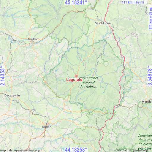
Laguiole GPS coordinates[2]
44° 41' 4.74" North, 2° 50' 47.976" East
| Map corner | latitude | longitude |
|---|---|---|
| Upper-left | 45.18241°, | 2.14353° |
| Center: | 44.68465°, | 2.84666° |
| Lower-right: | 44.18258°, | 3.54978° |
| Map W x H: | 111.2×111.2 km | = 69.1×69.1mi |
| max Lat: | 51.07786° ⇑82.2% North |
| Laguiole: | 44.68465° |
| min Lat: | ⇓17.8% South 41.3874° |
| min Long | Laguiole | max Long |
| -5.08615° | 2.84666° | 9.52242° |
| W 55.6%⇐ | ⇒44.4% E |
Elevation
Elevation of Laguiole is 1008 m = 3307 ft, and this is 814.3 m = 2672 ft above average elevation for this country.
| Max E: |
2333 m = 7654 ft | 0.90000000000001% |
| Laguiole | 1008 m 3307 ft | |
| Avg. | 193.7 m = 635 ft | |
Min E: |
-1 m = -3 ft | 99.1% |
See also: France elevation on elevation.city.
Geographical zone
Laguiole is located in North temperate zone (between Tropic of Cancer and the Arctic Circle). Distance of this Northern Tropic circle is 2362.5 km =1468 mi to South.| Distance of | km | miles | from Laguiole |
|---|---|---|---|
| North Pole | 5038.6 | 3130.8 | to North |
| Arctic Circle | 2432.7 | 1511.6 | to North |
| Tropic Cancer | 2362.5 | 1468 | to South |
| Equator | 4968.5 | 3087.3 | to South |


Nearby cities:
15 places around Laguiole: (largest is in red/bold)
• Brommat
20.5 km =12.7 mi,  321°
321°
• Castelnau-de-Mandailles
16.4 km =10.2 mi,  169°
169°
• Chaudes-Aigues
22.6 km =14 mi,  33°
33°
• Coubisou
17.4 km =10.8 mi,  212°
212°
• Entraygues-sur-Truyère
22.5 km =14 mi,  259°
259°
• Espalion
19.2 km =11.9 mi,  200°
200°
• Estaing
20 km =12.4 mi,  224°
224°
• Lacroix-Barrez
19.6 km =12.2 mi,  302°
302°
• Le Nayrac
16.4 km =10.2 mi,  241°
241°
• Montpeyroux
5.1 km =3.2 mi, 200°
• Nasbinals
16 km =9.9 mi,  98°
98°
• Saint-Amans-des-Cots
14.6 km =9.1 mi,  270°
270°
• Saint-Urcize
12.5 km =7.8 mi,  83°
83°
• Sainte-Geneviève-sur-Argence
14.8 km =9.2 mi,  332°
332°
• Taussac
22.8 km =14.2 mi,  314°
314°
Sources, notices
• [Note1] Compared only with cities in France existing in our database
• [Src1] Map data: © OpenStreetMap contributors (CC-BY-SA)
• [Src2] Other city data from geonames.org with taken over terms of usage.
• [Src3] Geographical zone / Annual Mean Temperature by Robert A. Rohde @ Wikipedia
