Chabottes geodata
Chabottes (Provence-Alpes-Côte d'Azur) is a populated place; located in France in Europe/Paris (GMT+2) time zone. With population of 655 people, there are 12455 cities with bigger population in this country. Compared to other cities in France, 82.4% of cities are located further ↑North; 89.1% of cities are located further ←West and 99.5% of cities have lower elevation than Chabottes. Note1
Administrative division(s):
- Level 1: Provence-Alpes-Côte d'Azur
- Level 2: Hautes-Alpes
- Level 3: Arrondissement de Gap
- Level 4: Chabottes


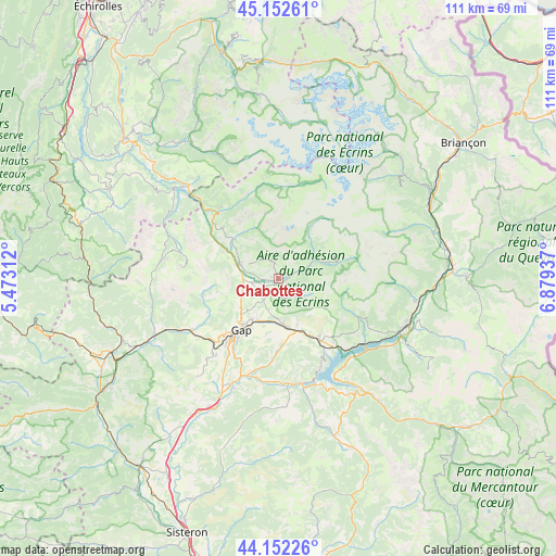
Chabottes GPS coordinates[2]
44° 39' 16.524" North, 6° 10' 34.464" East
| Map corner | latitude | longitude |
|---|---|---|
| Upper-left | 45.15261°, | 5.47312° |
| Center: | 44.65459°, | 6.17624° |
| Lower-right: | 44.15226°, | 6.87937° |
| Map W x H: | 111.2×111.2 km | = 69.1×69.1mi |
| max Lat: | 51.07786° ⇑82.4% North |
| Chabottes: | 44.65459° |
| min Lat: | ⇓17.6% South 41.3874° |
| min Long | Chabottes | max Long |
| -5.08615° | 6.17624° | 9.52242° |
| W 89.1%⇐ | ⇒10.9% E |
Elevation
Elevation of Chabottes is 1104 m = 3622 ft, and this is 910.3 m = 2987 ft above average elevation for this country.
| Max E: |
2333 m = 7654 ft | 0.5% |
| Chabottes | 1104 m 3622 ft | |
| Avg. | 193.7 m = 635 ft | |
Min E: |
-1 m = -3 ft | 99.5% |
See also: France elevation on elevation.city.
Geographical zone
Chabottes is located in North temperate zone (between Tropic of Cancer and the Arctic Circle). Distance of this Northern Tropic circle is 2359.2 km =1465.9 mi to South.| Distance of | km | miles | from Chabottes |
|---|---|---|---|
| North Pole | 5041.9 | 3132.9 | to North |
| Arctic Circle | 2436 | 1513.7 | to North |
| Tropic Cancer | 2359.2 | 1465.9 | to South |
| Equator | 4965.1 | 3085.2 | to South |


Nearby cities:
15 places around Chabottes: (largest is in red/bold)
• Ancelle
4.2 km =2.6 mi,  145°
145°
• Chorges
14.2 km =8.8 mi, 145°
• Embrun
27.2 km =16.9 mi,  111°
111°
• Espinasses
21.3 km =13.2 mi,  168°
168°
• Gap
13.2 km =8.2 mi,  215°
215°
• La Bâtie-Neuve
9.9 km =6.2 mi, 170°
• La Roche-des-Arnauds
20.3 km =12.6 mi,  239°
239°
• Le Dévoluy
19.1 km =11.9 mi,  283°
283°
• Neffes
20.7 km =12.9 mi, 216°
• Orcières
12.2 km =7.6 mi,  73°
73°
• Saint-Bonnet-en-Champsaur
8 km =5 mi,  293°
293°
• Saint-Jean
3.6 km =2.2 mi,  61°
61°
• Savines-le-Lac
23 km =14.3 mi,  128°
128°
• Sigoyer
25.3 km =15.7 mi, 218°
• Tallard
23.6 km =14.7 mi,  204°
204°
Sources, notices
• [Note1] Compared only with cities in France existing in our database
• [Src1] Map data: © OpenStreetMap contributors (CC-BY-SA)
• [Src2] Other city data from geonames.org with taken over terms of usage.
• [Src3] Geographical zone / Annual Mean Temperature by Robert A. Rohde @ Wikipedia
