Ancelle geodata
Ancelle (Provence-Alpes-Côte d'Azur) is a populated place; located in France in Europe/Paris (GMT+2) time zone. With population of 664 people, there are 12308 cities with bigger population in this country. Compared to other cities in France, 82.6% of cities are located further ↑North; 89.4% of cities are located further ←West and 99.8% of cities have lower elevation than Ancelle. Note1
Administrative division(s):
- Level 1: Provence-Alpes-Côte d'Azur
- Level 2: Hautes-Alpes
- Level 3: Arrondissement de Gap
- Level 4: Ancelle


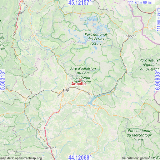
Ancelle GPS coordinates[2]
44° 37' 23.808" North, 6° 12' 22.5" East
| Map corner | latitude | longitude |
|---|---|---|
| Upper-left | 45.12157°, | 5.50313° |
| Center: | 44.62328°, | 6.20625° |
| Lower-right: | 44.12068°, | 6.90938° |
| Map W x H: | 111.3×111.3 km | = 69.2×69.2mi |
| max Lat: | 51.07786° ⇑82.6% North |
| Ancelle: | 44.62328° |
| min Lat: | ⇓17.4% South 41.3874° |
| min Long | Ancelle | max Long |
| -5.08615° | 6.20625° | 9.52242° |
| W 89.4%⇐ | ⇒10.6% E |
Elevation
Elevation of Ancelle is 1354 m = 4442 ft, and this is 1160.3 m = 3807 ft above average elevation for this country.
| Max E: |
2333 m = 7654 ft | 0.2% |
| Ancelle | 1354 m 4442 ft | |
| Avg. | 193.7 m = 635 ft | |
Min E: |
-1 m = -3 ft | 99.8% |
See also: France elevation on elevation.city.
Geographical zone
Ancelle is located in North temperate zone (between Tropic of Cancer and the Arctic Circle). Distance of this Northern Tropic circle is 2355.7 km =1463.8 mi to South.| Distance of | km | miles | from Ancelle |
|---|---|---|---|
| North Pole | 5045.4 | 3135.1 | to North |
| Arctic Circle | 2439.5 | 1515.8 | to North |
| Tropic Cancer | 2355.7 | 1463.8 | to South |
| Equator | 4961.6 | 3083 | to South |


Nearby cities:
15 places around Ancelle: (largest is in red/bold)
• Chabottes
4.2 km =2.6 mi,  325°
325°
• Chorges
10 km =6.2 mi,  145°
145°
• Embrun
23.8 km =14.8 mi,  106°
106°
• Espinasses
17.5 km =10.9 mi,  173°
173°
• Gap
12.4 km =7.7 mi,  234°
234°
• La Bâtie-Neuve
6.3 km =3.9 mi,  187°
187°
• La Roche-des-Arnauds
21 km =13 mi,  251°
251°
• Le Dévoluy
22.4 km =13.9 mi,  290°
290°
• Neffes
19.7 km =12.2 mi, 227°
• Orcières
11.6 km =7.2 mi,  53°
53°
• Saint-Bonnet-en-Champsaur
11.8 km =7.3 mi,  304°
304°
• Saint-Jean
5.3 km =3.3 mi,  8°
8°
• Savines-le-Lac
19 km =11.8 mi,  124°
124°
• Sigoyer
24.4 km =15.2 mi, 228°
• Tallard
21.7 km =13.5 mi,  214°
214°
Sources, notices
• [Note1] Compared only with cities in France existing in our database
• [Src1] Map data: © OpenStreetMap contributors (CC-BY-SA)
• [Src2] Other city data from geonames.org with taken over terms of usage.
• [Src3] Geographical zone / Annual Mean Temperature by Robert A. Rohde @ Wikipedia
