Bourg-Saint-Andéol geodata
Bourg-Saint-Andéol (Auvergne-Rhône-Alpes) is a populated place; located in France in Europe/Paris (GMT+2) time zone. With population of 8,301 people, there are 1167 cities with bigger population in this country. Compared to other cities in France, 84.4% of cities are located further ↑North; 73.2% of cities are located further ←West and 81.1% of cities have higher elevation than Bourg-Saint-Andéol. Note1
Administrative division(s):
- Level 1: Auvergne-Rhône-Alpes
- Level 2: Département de l'Ardèche
- Level 3: Arrondissement de Privas
- Level 4: Bourg-Saint-Andéol


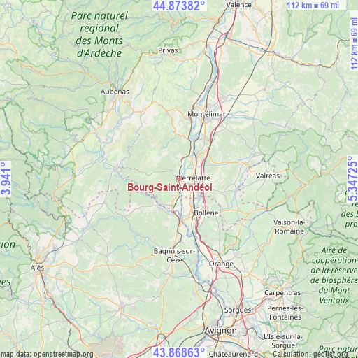
Bourg-Saint-Andéol GPS coordinates[2]
44° 22' 24.168" North, 4° 38' 38.868" East
| Map corner | latitude | longitude |
|---|---|---|
| Upper-left | 44.87382°, | 3.941° |
| Center: | 44.37338°, | 4.64413° |
| Lower-right: | 43.86863°, | 5.34725° |
| Map W x H: | 111.8×111.8 km | = 69.5×69.5mi |
| max Lat: | 51.07786° ⇑84.4% North |
| Bourg-Saint-Andéol: | 44.37338° |
| min Lat: | ⇓15.6% South 41.3874° |
| min Long | Bourg-Saint-And | max Long |
| -5.08615° | 4.64413° | 9.52242° |
| W 73.2%⇐ | ⇒26.8% E |
Elevation
Elevation of Bourg-Saint-Andéol is 52 m = 171 ft, and this is 141.7 m = 465 ft below average elevation for this country.
| Max E: |
2333 m = 7654 ft | 81.1% |
| Avg. | 193.7 m = 635 ft | |
| Bourg-Saint-Andéol | 52 m = 171 ft | |
Min E: |
-1 m = -3 ft | 18.9% |
See also: France elevation on elevation.city.
Geographical zone
Bourg-Saint-Andéol is located in North temperate zone (between Tropic of Cancer and the Arctic Circle). Distance of this Northern Tropic circle is 2327.9 km =1446.5 mi to South.| Distance of | km | miles | from Bourg-Saint-Andéol |
|---|---|---|---|
| North Pole | 5073.2 | 3152.3 | to North |
| Arctic Circle | 2467.3 | 1533.1 | to North |
| Tropic Cancer | 2327.9 | 1446.5 | to South |
| Equator | 4933.9 | 3065.8 | to South |


Nearby cities:
15 places around Bourg-Saint-Andéol: (largest is in red/bold)
• Bollène
13.2 km =8.2 mi,  140°
140°
• Donzère
9.4 km =5.8 mi,  34°
34°
• La Garde-Adhémar
9.4 km =5.8 mi,  73°
73°
• Lapalud
8.1 km =5 mi,  153°
153°
• Les Granges-Gontardes
10.7 km =6.6 mi,  63°
63°
• Pierrelatte
4.7 km =2.9 mi,  87°
87°
• Pont-Saint-Esprit
13.2 km =8.2 mi,  178°
178°
• Saint-Julien-de-Peyrolas
11.4 km =7.1 mi,  213°
213°
• Saint-Just-d'Ardèche
8.4 km =5.2 mi,  194°
194°
• Saint-Marcel-d'Ardèche
5.5 km =3.4 mi,  202°
202°
• Saint-Paul-Trois-Châteaux
10 km =6.2 mi,  107°
107°
• Saint-Paulet-de-Caisson
13.1 km =8.1 mi, 196°
• Saint-Remèze
11.5 km =7.1 mi,  280°
280°
• Saint-Restitut
13 km =8.1 mi, 114°
• Viviers
12.7 km =7.9 mi,  16°
16°
Sources, notices
• [Note1] Compared only with cities in France existing in our database
• [Src1] Map data: © OpenStreetMap contributors (CC-BY-SA)
• [Src2] Other city data from geonames.org with taken over terms of usage.
• [Src3] Geographical zone / Annual Mean Temperature by Robert A. Rohde @ Wikipedia
