Barbery geodata
Barbery (Hauts-de-France) is a populated place; located in France in Europe/Paris (GMT+2) time zone. With population of 552 people, there are 14174 cities with bigger population in this country. Compared to other cities in France, 84.7% of cities are located further ↓South; 53% of cities are located further ←West and 64% of cities have higher elevation than Barbery. Note1
Administrative division(s):
- Level 1: Hauts-de-France
- Level 2: Département de l'Oise
- Level 3: Arrondissement de Senlis
- Level 4: Barbery


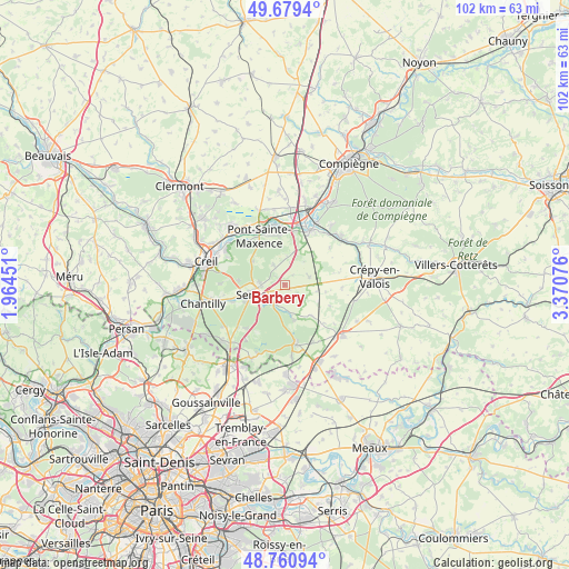
Barbery GPS coordinates[2]
49° 13' 20.28" North, 2° 40' 3.468" East
| Map corner | latitude | longitude |
|---|---|---|
| Upper-left | 49.6794°, | 1.96451° |
| Center: | 49.2223°, | 2.66763° |
| Lower-right: | 48.76094°, | 3.37076° |
| Map W x H: | 102.1×102.1 km | = 63.4×63.4mi |
| max Lat: | 51.07786° ⇑15.3% North |
| Barbery: | 49.2223° |
| min Lat: | ⇓84.7% South 41.3874° |
| min Long | Barbery | max Long |
| -5.08615° | 2.66763° | 9.52242° |
| W 53%⇐ | ⇒47% E |
Elevation
Elevation of Barbery is 92 m = 302 ft, and this is 101.7 m = 334 ft below average elevation for this country.
| Max E: |
2333 m = 7654 ft | 64% |
| Avg. | 193.7 m = 635 ft | |
| Barbery | 92 m = 302 ft | |
Min E: |
-1 m = -3 ft | 36% |
See also: France elevation on elevation.city.
Geographical zone
Barbery is located in North temperate zone (between Tropic of Cancer and the Arctic Circle). Distance of this North polar circle is 1928.2 km =1198.1 mi to North.| Distance of | km | miles | from Barbery |
|---|---|---|---|
| North Pole | 4534.1 | 2817.4 | to North |
| Arctic Circle | 1928.2 | 1198.1 | to North |
| Tropic Cancer | 2867.1 | 1781.5 | to South |
| Equator | 5473 | 3400.8 | to South |


Nearby cities:
15 places around Barbery: (largest is in red/bold)
• Aumont-en-Halatte
8.6 km =5.3 mi,  278°
278°
• Avilly-Saint-Léonard
9.7 km =6 mi,  251°
251°
• Baron
7.1 km =4.4 mi,  140°
140°
• Chamant
4.1 km =2.5 mi,  266°
266°
• Courteuil
10.1 km =6.3 mi,  255°
255°
• Fleurines
7.3 km =4.5 mi,  303°
303°
• Pont-Sainte-Maxence
9.9 km =6.2 mi,  332°
332°
• Pontpoint
8.7 km =5.4 mi,  351°
351°
• Rully
4.6 km =2.9 mi,  72°
72°
• Saint-Pierre
8.8 km =5.5 mi, 354°
• Saint-Vaast-de-Longmont
10.3 km =6.4 mi,  29°
29°
• Senlis
6.1 km =3.8 mi, 254°
• Trumilly
10 km =6.2 mi,  76°
76°
• Villeneuve-sur-Verberie
6 km =3.7 mi,  15°
15°
• Villers-Saint-Frambourg
4.1 km =2.5 mi, 330°
Sources, notices
• [Note1] Compared only with cities in France existing in our database
• [Src1] Map data: © OpenStreetMap contributors (CC-BY-SA)
• [Src2] Other city data from geonames.org with taken over terms of usage.
• [Src3] Geographical zone / Annual Mean Temperature by Robert A. Rohde @ Wikipedia
