Aumont-en-Halatte geodata
Aumont-en-Halatte (Hauts-de-France) is a populated place; located in France in Europe/Paris (GMT+2) time zone. With population of 528 people, there are 14653 cities with bigger population in this country. Compared to other cities in France, 84.9% of cities are located further ↓South; 51.4% of cities are located further ←West and 52.6% of cities have higher elevation than Aumont-en-Halatte. Note1
Administrative division(s):
- Level 1: Hauts-de-France
- Level 2: Département de l'Oise
- Level 3: Arrondissement de Senlis
- Level 4: Aumont-en-Halatte


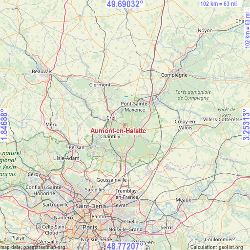
Aumont-en-Halatte GPS coordinates[2]
49° 13' 59.988" North, 2° 33' 0" East
| Map corner | latitude | longitude |
|---|---|---|
| Upper-left | 49.69032°, | 1.84688° |
| Center: | 49.23333°, | 2.55° |
| Lower-right: | 48.77207°, | 3.25313° |
| Map W x H: | 102.1×102.1 km | = 63.4×63.4mi |
| max Lat: | 51.07786° ⇑15.1% North |
| Aumont-en-Halatte: | 49.23333° |
| min Lat: | ⇓84.9% South 41.3874° |
| min Long | Aumont-en-Halat | max Long |
| -5.08615° | 2.55° | 9.52242° |
| W 51.4%⇐ | ⇒48.6% E |
Elevation
Elevation of Aumont-en-Halatte is 123 m = 404 ft, and this is 70.7 m = 232 ft below average elevation for this country.
| Max E: |
2333 m = 7654 ft | 52.6% |
| Avg. | 193.7 m = 635 ft | |
| Aumont-en-Halatte | 123 m = 404 ft | |
Min E: |
-1 m = -3 ft | 47.4% |
See also: France elevation on elevation.city.
Geographical zone
Aumont-en-Halatte is located in North temperate zone (between Tropic of Cancer and the Arctic Circle). Distance of this North polar circle is 1926.9 km =1197.3 mi to North.| Distance of | km | miles | from Aumont-en-Halatte |
|---|---|---|---|
| North Pole | 4532.8 | 2816.6 | to North |
| Arctic Circle | 1926.9 | 1197.3 | to North |
| Tropic Cancer | 2868.3 | 1782.3 | to South |
| Equator | 5474.2 | 3401.5 | to South |


Nearby cities:
15 places around Aumont-en-Halatte: (largest is in red/bold)
• Apremont
3.2 km =2 mi,  250°
250°
• Avilly-Saint-Léonard
4.4 km =2.7 mi,  188°
188°
• Chamant
4.7 km =2.9 mi,  108°
108°
• Chantilly
7.2 km =4.5 mi,  233°
233°
• Courteuil
3.9 km =2.4 mi,  198°
198°
• Creil
5.4 km =3.4 mi,  298°
298°
• Fleurines
3.8 km =2.4 mi,  40°
40°
• Nogent-sur-Oise
7.2 km =4.5 mi,  306°
306°
• Rieux
7.8 km =4.8 mi,  341°
341°
• Saint-Maximin
7.1 km =4.4 mi,  259°
259°
• Senlis
3.9 km =2.4 mi,  137°
137°
• Verneuil-en-Halatte
5.4 km =3.4 mi, 339°
• Villers-Saint-Frambourg
7 km =4.3 mi,  69°
69°
• Villers-Saint-Paul
7.6 km =4.7 mi,  324°
324°
• Vineuil-Saint-Firmin
5.4 km =3.4 mi, 227°
Sources, notices
• [Note1] Compared only with cities in France existing in our database
• [Src1] Map data: © OpenStreetMap contributors (CC-BY-SA)
• [Src2] Other city data from geonames.org with taken over terms of usage.
• [Src3] Geographical zone / Annual Mean Temperature by Robert A. Rohde @ Wikipedia
