Le Coudray-sur-Thelle geodata
Le Coudray-sur-Thelle (Hauts-de-France) is a populated place; located in France in Europe/Paris (GMT+2) time zone. With population of 507 people, there are 15105 cities with bigger population in this country. Compared to other cities in France, 86.2% of cities are located further ↓South; 55.5% of cities are located further →East and 69% of cities have lower elevation than Le Coudray-sur-Thelle. Note1
Administrative division(s):
- Level 1: Hauts-de-France
- Level 2: Département de l'Oise
- Level 3: Arrondissement de Beauvais
- Level 4: Le Coudray-sur-Thelle
Current local time in Le Coudray-sur-Thelle:
07:21 AM, SaturdayDifference from your time zone: hours


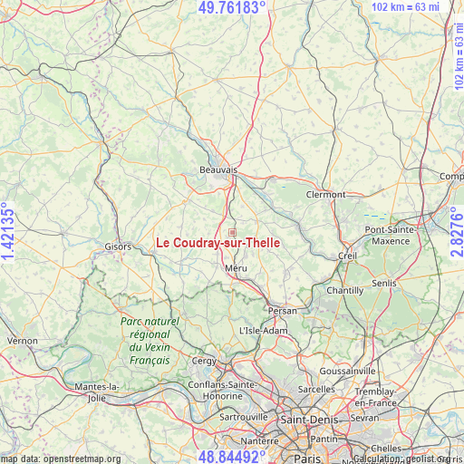
Le Coudray-sur-Thelle GPS coordinates[2]
49° 18' 19.836" North, 2° 7' 28.092" East
| Map corner | latitude | longitude |
|---|---|---|
| Upper-left | 49.76183°, | 1.42135° |
| Center: | 49.30551°, | 2.12447° |
| Lower-right: | 48.84492°, | 2.8276° |
| Map W x H: | 102×101.9 km | = 63.4×63.3mi |
| max Lat: | 51.07786° ⇑13.8% North |
| Le Coudray-sur-Thelle: | 49.30551° |
| min Lat: | ⇓86.2% South 41.3874° |
| min Long | Le Coudray-sur- | max Long |
| -5.08615° | 2.12447° | 9.52242° |
| W 44.5%⇐ | ⇒55.5% E |
Elevation
Elevation of Le Coudray-sur-Thelle is 214 m = 702 ft, and this is 20.3 m = 67 ft above average elevation for this country.
| Max E: |
2333 m = 7654 ft | 31% |
| Le Coudray-sur-Thelle | 214 m 702 ft | |
| Avg. | 193.7 m = 635 ft | |
Min E: |
-1 m = -3 ft | 69% |
See also: France elevation on elevation.city.
Geographical zone
Le Coudray-sur-Thelle is located in North temperate zone (between Tropic of Cancer and the Arctic Circle). Distance of this North polar circle is 1918.9 km =1192.3 mi to North.| Distance of | km | miles | from Le Coudray-sur-Thelle |
|---|---|---|---|
| North Pole | 4524.8 | 2811.6 | to North |
| Arctic Circle | 1918.9 | 1192.3 | to North |
| Tropic Cancer | 2876.3 | 1787.2 | to South |
| Equator | 5482.3 | 3406.5 | to South |


Nearby cities:
15 places around Le Coudray-sur-Thelle: (largest is in red/bold)
• Andeville
5.8 km =3.6 mi,  149°
149°
• Auteuil
4.9 km =3 mi,  326°
326°
• Berneuil-en-Bray
6.5 km =4 mi,  319°
319°
• Berthecourt
8.8 km =5.5 mi,  55°
55°
• Laboissière-en-Thelle
3 km =1.9 mi,  116°
116°
• Lormaison
5.6 km =3.5 mi,  193°
193°
• Mortefontaine-en-Thelle
6.5 km =4 mi,  135°
135°
• Méru
8.1 km =5 mi,  175°
175°
• Noailles
6.1 km =3.8 mi, 64°
• Ponchon
6.9 km =4.3 mi,  48°
48°
• Saint-Crépin-Ibouvillers
5.8 km =3.6 mi,  215°
215°
• Saint-Sulpice
5 km =3.1 mi,  358°
358°
• Sainte-Geneviève
5.7 km =3.5 mi,  108°
108°
• Valdampierre
5.2 km =3.2 mi,  268°
268°
• Villeneuve-les-Sablons
8.3 km =5.2 mi,  204°
204°
Sources, notices
• [Note1] Compared only with cities in France existing in our database
• [Src1] Map data: © OpenStreetMap contributors (CC-BY-SA)
• [Src2] Other city data from geonames.org with taken over terms of usage.
• [Src3] Geographical zone / Annual Mean Temperature by Robert A. Rohde @ Wikipedia
