Eláti geodata
Eláti (West Macedonia) is a populated place; located in Greece in Europe/Athens (GMT+3) time zone. With population of 806 people, there are 1267 cities with bigger population in this country. Compared to other cities in Greece, 66.5% of cities are located further ↓South; 75.8% of cities are located further →East and 93.8% of cities have lower elevation than Eláti. Note1
Administrative division(s):
- Level 1: West Macedonia
- Level 2: Nomós Kozánis
- Level 3: Dimos Servia-Velventos


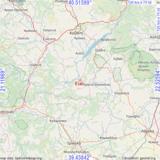
Eláti GPS coordinates[2]
39° 58' 45.588" North, 21° 49' 22.116" East
| Map corner | latitude | longitude |
|---|---|---|
| Upper-left | 40.51599°, | 21.11969° |
| Center: | 39.97933°, | 21.82281° |
| Lower-right: | 39.43842°, | 22.52594° |
| Map W x H: | 119.8×119.8 km | = 74.4×74.4mi |
| max Lat: | 41.72048° ⇑33.5% North |
| Eláti: | 39.97933° |
| min Lat: | ⇓66.5% South 34.8346° |
| min Long | Eláti | max Long |
| 19.40494° | 21.82281° | 29.59361° |
| W 24.2%⇐ | ⇒75.8% E |
Elevation
Elevation of Eláti is 630 m = 2067 ft, and this is 461.1 m = 1513 ft above average elevation for this country.
| Max E: |
1439 m = 4721 ft | 6.2% |
| Eláti | 630 m 2067 ft | |
| Avg. | 168.9 m = 554 ft | |
Min E: |
0 m = 0 ft | 93.8% |
See also: Greece elevation on elevation.city.
Geographical zone
Eláti is located in North temperate zone (between Tropic of Cancer and the Arctic Circle). Distance of this Northern Tropic circle is 1839.4 km =1142.9 mi to South.| Distance of | km | miles | from Eláti |
|---|---|---|---|
| North Pole | 5561.8 | 3455.9 | to North |
| Arctic Circle | 2955.9 | 1836.7 | to North |
| Tropic Cancer | 1839.4 | 1142.9 | to South |
| Equator | 4445.3 | 2762.2 | to South |


Nearby cities:
15 places around Eláti: (largest is in red/bold)
• Agiófyllo
25.7 km =16 mi,  239°
239°
• Aianí
20.5 km =12.7 mi,  359°
359°
• Asprokklisiá
19.8 km =12.3 mi,  223°
223°
• Deskáti
6.2 km =3.9 mi,  189°
189°
• Dímitra
14.2 km =8.8 mi,  255°
255°
• Karperó
17.8 km =11.1 mi, 258°
• Kastaniá
27.6 km =17.1 mi,  38°
38°
• Kraniá Elassónas
13 km =8.1 mi,  104°
104°
• Livaderó
11.9 km =7.4 mi,  58°
58°
• Loutró
9.5 km =5.9 mi, 98°
• Sarantáporo
21.9 km =13.6 mi, 63°
• Sérvia
26.6 km =16.5 mi,  33°
33°
• Verdikoússa
25.6 km =15.9 mi,  149°
149°
• Áno Kómi
27.5 km =17.1 mi,  0°
0°
• Ázoros
22 km =13.7 mi,  83°
83°
Sources, notices
• [Note1] Compared only with cities in Greece existing in our database
• [Src1] Map data: © OpenStreetMap contributors (CC-BY-SA)
• [Src2] Other city data from geonames.org with taken over terms of usage.
• [Src3] Geographical zone / Annual Mean Temperature by Robert A. Rohde @ Wikipedia
