Cajolá geodata
Cajolá (Quetzaltenango) is a seat of a second-order administrative division; located in Guatemala in America/Guatemala (GMT-6) time zone. With population of 2,927 people, there are 245 cities with bigger population in this country. Compared to other cities in Guatemala, 59.3% of cities are located further ↓South; 79.9% of cities are located further →East and 92.3% of cities have lower elevation than Cajolá. Note1


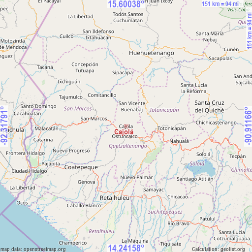
Cajolá GPS coordinates[2]
14° 55' 19.38" North, 91° 36' 53.208" West
| Map corner | latitude | longitude |
|---|---|---|
| Upper-left | 15.60038°, | -92.31791° |
| Center: | 14.92205°, | -91.61478° |
| Lower-right: | 14.24158°, | -90.91166° |
| Map W x H: | 151.1×151.1 km | = 93.9×93.9mi |
| max Lat: | 17.06606° ⇑40.7% North |
| Cajolá: | 14.92205° |
| min Lat: | ⇓59.3% South 13.9274° |
| min Long | Cajolá | max Long |
| -92.19298° | -91.61478° | -88.59444° |
| W 20.1%⇐ | ⇒79.9% E |
Elevation
Elevation of Cajolá is 2496 m = 8189 ft, and this is 1229 m = 4032 ft above average elevation for this country.
| Max E: |
3254 m = 10676 ft | 7.7% |
| Cajolá | 2496 m 8189 ft | |
| Avg. | 1267 m = 4157 ft | |
Min E: |
1 m = 3 ft | 92.3% |
See also: Guatemala elevation on elevation.city.
Geographical zone
Cajolá is located in North Torrid zone (between Equator and Tropic of Cancer). Distance of this Northern Tropic circle is 946.7 km =588.3 mi to North.| Distance of | km | miles | from Cajolá |
|---|---|---|---|
| North Pole | 8347.9 | 5187.1 | to North |
| Arctic Circle | 5742 | 3567.9 | to North |
| Tropic Cancer | 946.7 | 588.3 | to North |
| Equator | 1659.2 | 1031 | to South |


Nearby cities:
15 places around Cajolá: (largest is in red/bold)
• Concepción Chiquirichapa
7.5 km =4.7 mi,  187°
187°
• La Esperanza
8 km =5 mi,  134°
134°
• Olintepeque
11.5 km =7.1 mi,  110°
110°
• Ostuncalco
5.9 km =3.7 mi, 186°
• Palestina de los Altos
8.6 km =5.3 mi,  278°
278°
• Quetzaltenango
14.2 km =8.8 mi, 133°
• San Andrés Xecul
14.3 km =8.9 mi,  97°
97°
• San Antonio Sacatepéquez
13.3 km =8.3 mi,  288°
288°
• San Carlos Sija
9.9 km =6.2 mi,  45°
45°
• San Francisco la Unión
7.9 km =4.9 mi,  88°
88°
• San Juan Ostuncalco
9.7 km =6 mi,  236°
236°
• San Martín Sacatepéquez
11.2 km =7 mi,  195°
195°
• San Mateo
7.6 km =4.7 mi,  159°
159°
• San Miguel Sigüilá
3 km =1.9 mi,  179°
179°
• Sibilia
8 km =5 mi,  353°
353°
Sources, notices
• [Note1] Compared only with cities in Guatemala existing in our database
• [Src1] Map data: © OpenStreetMap contributors (CC-BY-SA)
• [Src2] Other city data from geonames.org with taken over terms of usage.
• [Src3] Geographical zone / Annual Mean Temperature by Robert A. Rohde @ Wikipedia
