Sibilia geodata
Sibilia (Quetzaltenango) is a seat of a second-order administrative division; located in Guatemala in America/Guatemala (GMT-6) time zone. With population of 1,180 people, there are 308 cities with bigger population in this country. Compared to other cities in Guatemala, 66.7% of cities are located further ↓South; 81.1% of cities are located further →East and 98.5% of cities have lower elevation than Sibilia. Note1


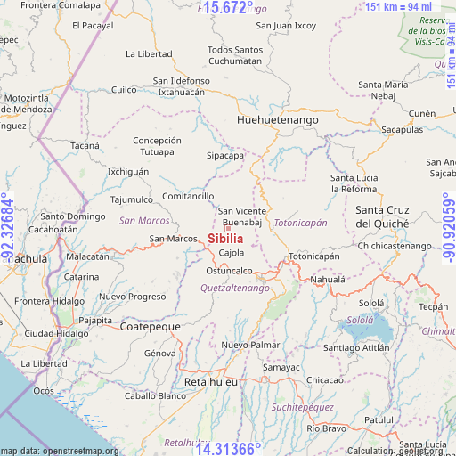
Sibilia GPS coordinates[2]
14° 59' 38.076" North, 91° 37' 25.356" West
| Map corner | latitude | longitude |
|---|---|---|
| Upper-left | 15.672°, | -92.32684° |
| Center: | 14.99391°, | -91.62371° |
| Lower-right: | 14.31366°, | -90.92059° |
| Map W x H: | 151×151 km | = 93.8×93.8mi |
| max Lat: | 17.06606° ⇑33.3% North |
| Sibilia: | 14.99391° |
| min Lat: | ⇓66.7% South 13.9274° |
| min Long | Sibilia | max Long |
| -92.19298° | -91.62371° | -88.59444° |
| W 18.9%⇐ | ⇒81.1% E |
Elevation
Elevation of Sibilia is 2764 m = 9068 ft, and this is 1497 m = 4911 ft above average elevation for this country.
| Max E: |
3254 m = 10676 ft | 1.5% |
| Sibilia | 2764 m 9068 ft | |
| Avg. | 1267 m = 4157 ft | |
Min E: |
1 m = 3 ft | 98.5% |
See also: Guatemala elevation on elevation.city.
Geographical zone
Sibilia is located in North Torrid zone (between Equator and Tropic of Cancer). Distance of this Northern Tropic circle is 938.8 km =583.3 mi to North.| Distance of | km | miles | from Sibilia |
|---|---|---|---|
| North Pole | 8339.9 | 5182.2 | to North |
| Arctic Circle | 5734 | 3562.9 | to North |
| Tropic Cancer | 938.8 | 583.3 | to North |
| Equator | 1667.2 | 1035.9 | to South |


Nearby cities:
15 places around Sibilia: (largest is in red/bold)
• Cabricán
9.4 km =5.8 mi,  343°
343°
• Cajolá
8 km =5 mi,  173°
173°
• Concepción Chiquirichapa
15.4 km =9.6 mi,  179°
179°
• Huitán
6.4 km =4 mi, 344°
• La Esperanza
15.1 km =9.4 mi,  153°
153°
• Ostuncalco
13.9 km =8.6 mi, 178°
• Palestina de los Altos
10.1 km =6.3 mi,  228°
228°
• Río Blanco
8.2 km =5.1 mi,  306°
306°
• San Antonio Sacatepéquez
12.2 km =7.6 mi,  252°
252°
• San Carlos Sija
8.1 km =5 mi,  97°
97°
• San Francisco la Unión
11.8 km =7.3 mi,  131°
131°
• San Juan Ostuncalco
15.2 km =9.4 mi,  207°
207°
• San Lorenzo
12.7 km =7.9 mi,  288°
288°
• San Miguel Sigüilá
11 km =6.8 mi, 174°
• San Pedro Sacatepéquez
15.1 km =9.4 mi,  259°
259°
Sources, notices
• [Note1] Compared only with cities in Guatemala existing in our database
• [Src1] Map data: © OpenStreetMap contributors (CC-BY-SA)
• [Src2] Other city data from geonames.org with taken over terms of usage.
• [Src3] Geographical zone / Annual Mean Temperature by Robert A. Rohde @ Wikipedia
