San Carlos Sija geodata
San Carlos Sija (Quetzaltenango) is a seat of a second-order administrative division; located in Guatemala in America/Guatemala (GMT-6) time zone. With population of 6,831 people, there are 176 cities with bigger population in this country. Compared to other cities in Guatemala, 66.1% of cities are located further ↓South; 76.1% of cities are located further →East and 97.9% of cities have lower elevation than San Carlos Sija. Note1


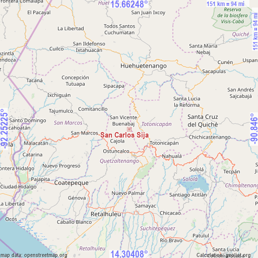
San Carlos Sija GPS coordinates[2]
14° 59' 3.696" North, 91° 32' 56.832" West
| Map corner | latitude | longitude |
|---|---|---|
| Upper-left | 15.66248°, | -92.25225° |
| Center: | 14.98436°, | -91.54912° |
| Lower-right: | 14.30408°, | -90.846° |
| Map W x H: | 151×151 km | = 93.8×93.8mi |
| max Lat: | 17.06606° ⇑33.9% North |
| San Carlos Sija: | 14.98436° |
| min Lat: | ⇓66.1% South 13.9274° |
| min Long | San Carlos Sija | max Long |
| -92.19298° | -91.54912° | -88.59444° |
| W 23.9%⇐ | ⇒76.1% E |
Elevation
Elevation of San Carlos Sija is 2730 m = 8957 ft, and this is 1463 m = 4800 ft above average elevation for this country.
| Max E: |
3254 m = 10676 ft | 2.1% |
| San Carlos Sija | 2730 m 8957 ft | |
| Avg. | 1267 m = 4157 ft | |
Min E: |
1 m = 3 ft | 97.9% |
See also: Guatemala elevation on elevation.city.
Geographical zone
San Carlos Sija is located in North Torrid zone (between Equator and Tropic of Cancer). Distance of this Northern Tropic circle is 939.8 km =584 mi to North.| Distance of | km | miles | from San Carlos Sija |
|---|---|---|---|
| North Pole | 8341 | 5182.9 | to North |
| Arctic Circle | 5735.1 | 3563.6 | to North |
| Tropic Cancer | 939.8 | 584 | to North |
| Equator | 1666.1 | 1035.3 | to South |


Nearby cities:
15 places around San Carlos Sija: (largest is in red/bold)
• Cabricán
14.6 km =9.1 mi,  313°
313°
• Cajolá
9.9 km =6.2 mi,  225°
225°
• Huitán
12.1 km =7.5 mi, 306°
• La Esperanza
12.6 km =7.8 mi,  186°
186°
• Olintepeque
11.5 km =7.1 mi,  161°
161°
• Ostuncalco
15 km =9.3 mi,  211°
211°
• Salcajá
15.3 km =9.5 mi,  139°
139°
• San Andrés Xecul
11.3 km =7 mi, 141°
• San Bartolo
15 km =9.3 mi,  41°
41°
• San Cristóbal Totonicapán
13.9 km =8.6 mi,  122°
122°
• San Francisco El Alto
12.2 km =7.6 mi,  111°
111°
• San Francisco la Unión
6.8 km =4.2 mi,  173°
173°
• San Mateo
14.7 km =9.1 mi,  197°
197°
• San Miguel Sigüilá
12.1 km =7.5 mi,  215°
215°
• Sibilia
8.1 km =5 mi,  277°
277°
Sources, notices
• [Note1] Compared only with cities in Guatemala existing in our database
• [Src1] Map data: © OpenStreetMap contributors (CC-BY-SA)
• [Src2] Other city data from geonames.org with taken over terms of usage.
• [Src3] Geographical zone / Annual Mean Temperature by Robert A. Rohde @ Wikipedia
