Palín geodata
Palín (Escuintla) is a seat of a second-order administrative division; located in Guatemala in America/Guatemala (GMT-6) time zone. With population of 31,329 people, there are 35 cities with bigger population in this country. Compared to other cities in Guatemala, 87.9% of cities are located further ↑North; 59.9% of cities are located further ←West and 54.3% of cities have higher elevation than Palín. Note1


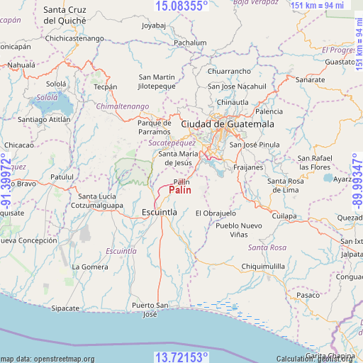
Palín GPS coordinates[2]
14° 24' 12.888" North, 90° 41' 47.724" West
| Map corner | latitude | longitude |
|---|---|---|
| Upper-left | 15.08355°, | -91.39972° |
| Center: | 14.40358°, | -90.69659° |
| Lower-right: | 13.72153°, | -89.99347° |
| Map W x H: | 151.4×151.4 km | = 94.1×94.1mi |
| max Lat: | 17.06606° ⇑87.9% North |
| Palín: | 14.40358° |
| min Lat: | ⇓12.1% South 13.9274° |
| min Long | Palín | max Long |
| -92.19298° | -90.69659° | -88.59444° |
| W 59.9%⇐ | ⇒40.1% E |
Elevation
Elevation of Palín is 1138 m = 3734 ft, and this is 129 m = 423 ft below average elevation for this country.
| Max E: |
3254 m = 10676 ft | 54.3% |
| Avg. | 1267 m = 4157 ft | |
| Palín | 1138 m = 3734 ft | |
Min E: |
1 m = 3 ft | 45.7% |
See also: Guatemala elevation on elevation.city.
Geographical zone
Palín is located in North Torrid zone (between Equator and Tropic of Cancer). Distance of this Northern Tropic circle is 1004.4 km =624.1 mi to North.| Distance of | km | miles | from Palín |
|---|---|---|---|
| North Pole | 8405.5 | 5222.9 | to North |
| Arctic Circle | 5799.6 | 3603.7 | to North |
| Tropic Cancer | 1004.4 | 624.1 | to North |
| Equator | 1601.5 | 995.1 | to South |


Nearby cities:
15 places around Palín: (largest is in red/bold)
• Alotenango
14.7 km =9.1 mi,  305°
305°
• Amatitlán
10.6 km =6.6 mi,  38°
38°
• Antigua Guatemala
18 km =11.2 mi,  346°
346°
• Ciudad Vieja
15.2 km =9.4 mi,  331°
331°
• Escuintla
14.5 km =9 mi,  220°
220°
• Magdalena Milpas Altas
16.2 km =10.1 mi,  8°
8°
• Petapa
18.2 km =11.3 mi,  52°
52°
• San Antonio Aguas Calientes
18.3 km =11.4 mi, 330°
• San Miguel Dueñas
17.2 km =10.7 mi,  320°
320°
• San Vicente Pacaya
6.6 km =4.1 mi,  79°
79°
• Santa Catarina Barahona
19 km =11.8 mi, 329°
• Santa Lucía Milpas Altas
19.4 km =12.1 mi, 6°
• Santa María de Jesús
10.2 km =6.3 mi, 351°
• Villa Canales
19.6 km =12.2 mi,  63°
63°
• Villa Nueva
18.1 km =11.2 mi, 41°
Sources, notices
• [Note1] Compared only with cities in Guatemala existing in our database
• [Src1] Map data: © OpenStreetMap contributors (CC-BY-SA)
• [Src2] Other city data from geonames.org with taken over terms of usage.
• [Src3] Geographical zone / Annual Mean Temperature by Robert A. Rohde @ Wikipedia
