Panzós geodata
Panzós (Alta Verapaz) is a seat of a second-order administrative division; located in Guatemala in America/Guatemala (GMT-6) time zone. With population of 25,569 people, there are 43 cities with bigger population in this country. Compared to other cities in Guatemala, 83.5% of cities are located further ↓South; 91.4% of cities are located further ←West and 91.4% of cities have higher elevation than Panzós. Note1


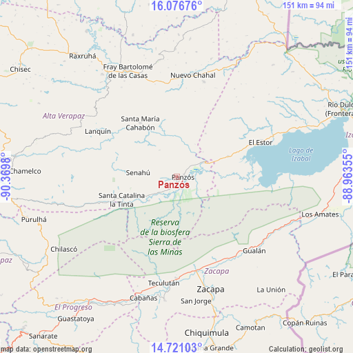
Panzós GPS coordinates[2]
15° 24' 0" North, 89° 40' 0.012" West
| Map corner | latitude | longitude |
|---|---|---|
| Upper-left | 16.07676°, | -90.3698° |
| Center: | 15.4°, | -89.66667° |
| Lower-right: | 14.72103°, | -88.96355° |
| Map W x H: | 150.7×150.7 km | = 93.6×93.6mi |
| max Lat: | 17.06606° ⇑16.5% North |
| Panzós: | 15.4° |
| min Lat: | ⇓83.5% South 13.9274° |
| min Long | Panzós | max Long |
| -92.19298° | -89.66667° | -88.59444° |
| W 91.4%⇐ | ⇒8.6% E |
Elevation
Elevation of Panzós is 175 m = 574 ft, and this is 1092 m = 3583 ft below average elevation for this country.
| Max E: |
3254 m = 10676 ft | 91.4% |
| Avg. | 1267 m = 4157 ft | |
| Panzós | 175 m = 574 ft | |
Min E: |
1 m = 3 ft | 8.6% |
See also: Guatemala elevation on elevation.city.
Geographical zone
Panzós is located in North Torrid zone (between Equator and Tropic of Cancer). Distance of this Northern Tropic circle is 893.6 km =555.3 mi to North.| Distance of | km | miles | from Panzós |
|---|---|---|---|
| North Pole | 8294.7 | 5154.1 | to North |
| Arctic Circle | 5688.9 | 3534.9 | to North |
| Tropic Cancer | 893.6 | 555.3 | to North |
| Equator | 1712.3 | 1064 | to South |


Nearby cities:
15 places around Panzós: (largest is in red/bold)
• Cahabón
24.5 km =15.2 mi,  319°
319°
• Chahal Guatemala
44 km =27.3 mi,  8°
8°
• El Estor
37 km =23 mi,  66°
66°
• Estanzuela
45.8 km =28.5 mi,  166°
166°
• Fray Bartolomé de Las Casas
52 km =32.3 mi,  332°
332°
• Gualán
45.5 km =28.3 mi,  133°
133°
• Huité
52.2 km =32.4 mi,  185°
185°
• La Tinta
25 km =15.5 mi,  248°
248°
• Lanquín
37.1 km =23.1 mi,  299°
299°
• Río Hondo
38.1 km =23.7 mi, 166°
• Senahú
17.9 km =11.1 mi,  270°
270°
• Teculután
46.6 km =29 mi, 186°
• Tucurú
44.3 km =27.5 mi,  255°
255°
• Usumatlán
51.6 km =32.1 mi, 194°
• Zacapa
49.8 km =30.9 mi,  162°
162°
Sources, notices
• [Note1] Compared only with cities in Guatemala existing in our database
• [Src1] Map data: © OpenStreetMap contributors (CC-BY-SA)
• [Src2] Other city data from geonames.org with taken over terms of usage.
• [Src3] Geographical zone / Annual Mean Temperature by Robert A. Rohde @ Wikipedia
