La Tinta geodata
La Tinta (Alta Verapaz) is a seat of a second-order administrative division; located in Guatemala in America/Guatemala (GMT-6) time zone. In our database, there are 325 cities with bigger population. Compared to other cities in Guatemala, 79.9% of cities are located further ↓South; 85% of cities are located further ←West and 95.3% of cities have higher elevation than La Tinta. Note1


La Tinta GPS coordinates[2]
15° 19' 0.012" North, 89° 52' 59.988" West
| Map corner | latitude | longitude |
|---|---|---|
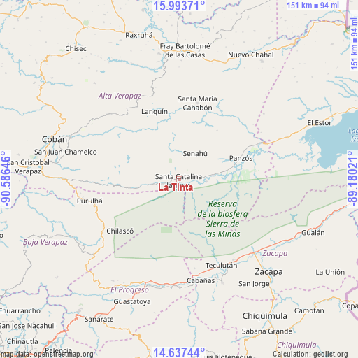
| Upper-left | 15.99371°, | -90.58646° |
| Center: | 15.31667°, | -89.88333° |
| Lower-right: | 14.63744°, | -89.18021° |
| Map W x H: | 150.8×150.8 km | = 93.7×93.7mi |
| max Lat: | 17.06606° ⇑20.1% North |
| La Tinta: | 15.31667° |
| min Lat: | ⇓79.9% South 13.9274° |
| min Long | La Tinta | max Long |
| -92.19298° | -89.88333° | -88.59444° |
| W 85%⇐ | ⇒15% E |
Elevation
Elevation of La Tinta is 100 m = 328 ft, and this is 1167 m = 3829 ft below average elevation for this country.
| Max E: |
3254 m = 10676 ft | 95.3% |
| Avg. | 1267 m = 4157 ft | |
| La Tinta | 100 m = 328 ft | |
Min E: |
1 m = 3 ft | 4.7% |
See also: Guatemala elevation on elevation.city.
Geographical zone
La Tinta is located in North Torrid zone (between Equator and Tropic of Cancer). Distance of this Northern Tropic circle is 902.9 km =561 mi to North.| Distance of | km | miles | from La Tinta |
|---|---|---|---|
| North Pole | 8304 | 5159.9 | to North |
| Arctic Circle | 5698.1 | 3540.6 | to North |
| Tropic Cancer | 902.9 | 561 | to North |
| Equator | 1703.1 | 1058.3 | to South |


Nearby cities:
15 places around La Tinta: (largest is in red/bold)
• Cabañas
43.6 km =27.1 mi,  168°
168°
• Cahabón
28.7 km =17.8 mi,  14°
14°
• El Jícaro
44.5 km =27.7 mi,  182°
182°
• Lanquín
29.2 km =18.1 mi,  342°
342°
• Panzós
25 km =15.5 mi,  68°
68°
• Purulhá
34.4 km =21.4 mi,  260°
260°
• Río Hondo
42.5 km =26.4 mi,  130°
130°
• San Agustín Acasaguastlán
41.7 km =25.9 mi,  192°
192°
• San Cristóbal Acasaguastlán
44.5 km =27.7 mi, 180°
• San Pedro Carchá
45.1 km =28 mi,  294°
294°
• Senahú
10.7 km =6.6 mi,  30°
30°
• Tamahú
37.8 km =23.5 mi,  268°
268°
• Teculután
41.2 km =25.6 mi,  154°
154°
• Tucurú
19.7 km =12.2 mi, 264°
• Usumatlán
42.2 km =26.2 mi, 165°
Sources, notices
• [Note1] Compared only with cities in Guatemala existing in our database
• [Src1] Map data: © OpenStreetMap contributors (CC-BY-SA)
• [Src2] Other city data from geonames.org with taken over terms of usage.
• [Src3] Geographical zone / Annual Mean Temperature by Robert A. Rohde @ Wikipedia
