Chahal Guatemala geodata
Chahal Guatemala (Alta Verapaz) is a populated place; located in Guatemala in America/Guatemala (GMT-6) time zone. With population of 7,465 people, there are 167 cities with bigger population in this country. Compared to other cities in Guatemala, 93.5% of cities are located further ↓South; 92.6% of cities are located further ←West and 91.2% of cities have higher elevation than Chahal Guatemala. Note1


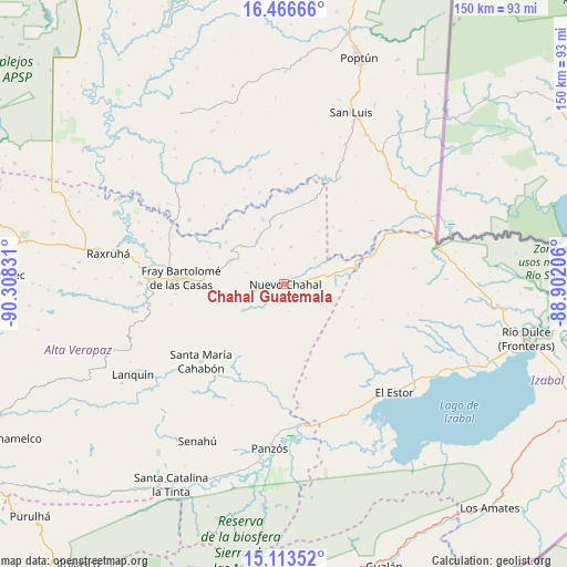
Chahal Guatemala GPS coordinates[2]
15° 47' 28.392" North, 89° 36' 18.648" West
| Map corner | latitude | longitude |
|---|---|---|
| Upper-left | 16.46666°, | -90.30831° |
| Center: | 15.79122°, | -89.60518° |
| Lower-right: | 15.11352°, | -88.90206° |
| Map W x H: | 150.5×150.5 km | = 93.5×93.5mi |
| max Lat: | 17.06606° ⇑6.5% North |
| Chahal Guatemala: | 15.79122° |
| min Lat: | ⇓93.5% South 13.9274° |
| min Long | Chahal Guatemal | max Long |
| -92.19298° | -89.60518° | -88.59444° |
| W 92.6%⇐ | ⇒7.4% E |
Elevation
Elevation of Chahal Guatemala is 178 m = 584 ft, and this is 1089 m = 3573 ft below average elevation for this country.
| Max E: |
3254 m = 10676 ft | 91.2% |
| Avg. | 1267 m = 4157 ft | |
| Chahal Guatemala | 178 m = 584 ft | |
Min E: |
1 m = 3 ft | 8.8% |
See also: Guatemala elevation on elevation.city.
Geographical zone
Chahal Guatemala is located in North Torrid zone (between Equator and Tropic of Cancer). Distance of this Northern Tropic circle is 850.1 km =528.2 mi to North.| Distance of | km | miles | from Chahal Guatemala |
|---|---|---|---|
| North Pole | 8251.2 | 5127.1 | to North |
| Arctic Circle | 5645.4 | 3507.9 | to North |
| Tropic Cancer | 850.1 | 528.2 | to North |
| Equator | 1755.8 | 1091 | to South |


Nearby cities:
15 places around Chahal Guatemala: (largest is in red/bold)
• Cahabón
33.7 km =20.9 mi,  222°
222°
• Chisec
72.6 km =45.1 mi,  272°
272°
• El Estor
39.6 km =24.6 mi,  136°
136°
• Fray Bartolomé de Las Casas
30.5 km =19 mi,  275°
275°
• Gualán
79.3 km =49.3 mi,  160°
160°
• La Tinta
60.6 km =37.7 mi,  209°
209°
• Lanquín
46.1 km =28.6 mi,  237°
237°
• Los Amates
80.6 km =50.1 mi, 137°
• Panzós
44 km =27.3 mi,  188°
188°
• Poptún
63.3 km =39.3 mi,  18°
18°
• Raxruhá
46.6 km =29 mi, 280°
• San Luis
48.6 km =30.2 mi, 21°
• San Pedro Carchá
78.7 km =48.9 mi, 244°
• Senahú
49.9 km =31 mi, 209°
• Tucurú
73.7 km =45.8 mi, 222°
Sources, notices
• [Note1] Compared only with cities in Guatemala existing in our database
• [Src1] Map data: © OpenStreetMap contributors (CC-BY-SA)
• [Src2] Other city data from geonames.org with taken over terms of usage.
• [Src3] Geographical zone / Annual Mean Temperature by Robert A. Rohde @ Wikipedia
