Purulhá geodata
Purulhá (Baja Verapaz) is a seat of a second-order administrative division; located in Guatemala in America/Guatemala (GMT-6) time zone. With population of 5,370 people, there are 199 cities with bigger population in this country. Compared to other cities in Guatemala, 77.9% of cities are located further ↓South; 76.1% of cities are located further ←West and 79.4% of cities have lower elevation than Purulhá. Note1


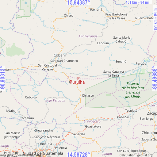
Purulhá GPS coordinates[2]
15° 16' 0.012" North, 90° 12' 0" West
| Map corner | latitude | longitude |
|---|---|---|
| Upper-left | 15.94387°, | -90.90313° |
| Center: | 15.26667°, | -90.2° |
| Lower-right: | 14.58728°, | -89.49688° |
| Map W x H: | 150.8×150.8 km | = 93.7×93.7mi |
| max Lat: | 17.06606° ⇑22.1% North |
| Purulhá: | 15.26667° |
| min Lat: | ⇓77.9% South 13.9274° |
| min Long | Purulhá | max Long |
| -92.19298° | -90.2° | -88.59444° |
| W 76.1%⇐ | ⇒23.9% E |
Elevation
Elevation of Purulhá is 2084 m = 6837 ft, and this is 817 m = 2680 ft above average elevation for this country.
| Max E: |
3254 m = 10676 ft | 20.6% |
| Purulhá | 2084 m 6837 ft | |
| Avg. | 1267 m = 4157 ft | |
Min E: |
1 m = 3 ft | 79.4% |
See also: Guatemala elevation on elevation.city.
Geographical zone
Purulhá is located in North Torrid zone (between Equator and Tropic of Cancer). Distance of this Northern Tropic circle is 908.4 km =564.5 mi to North.| Distance of | km | miles | from Purulhá |
|---|---|---|---|
| North Pole | 8309.6 | 5163.3 | to North |
| Arctic Circle | 5703.7 | 3544.1 | to North |
| Tropic Cancer | 908.4 | 564.5 | to North |
| Equator | 1697.5 | 1054.8 | to South |


Nearby cities:
15 places around Purulhá: (largest is in red/bold)
• Cobán
29.2 km =18.1 mi,  321°
321°
• La Tinta
34.4 km =21.4 mi,  80°
80°
• Lanquín
41.7 km =25.9 mi,  36°
36°
• Morazán
37.6 km =23.4 mi,  170°
170°
• Rabinal
37.3 km =23.2 mi,  237°
237°
• Salamá
22.2 km =13.8 mi,  214°
214°
• San Cristóbal Verapaz
41.7 km =25.9 mi,  290°
290°
• San Jerónimo
23.4 km =14.5 mi,  190°
190°
• San Juan Chamelco
23.4 km =14.5 mi, 322°
• San Miguel Chicaj
28.3 km =17.6 mi,  227°
227°
• San Pedro Carchá
25.1 km =15.6 mi,  343°
343°
• Santa Cruz Verapaz
27.4 km =17 mi, 293°
• Tactic
17.7 km =11 mi, 290°
• Tamahú
6.1 km =3.8 mi, 320°
• Tucurú
14.8 km =9.2 mi, 75°
Sources, notices
• [Note1] Compared only with cities in Guatemala existing in our database
• [Src1] Map data: © OpenStreetMap contributors (CC-BY-SA)
• [Src2] Other city data from geonames.org with taken over terms of usage.
• [Src3] Geographical zone / Annual Mean Temperature by Robert A. Rohde @ Wikipedia
