Petite Rivière de Nippes geodata
Petite Rivière de Nippes (GrandʼAnse) is a populated place; located in Haiti in America/Port-au-Prince (GMT-4) time zone. With population of 1,794 people, there are 82 cities with bigger population in this country. Compared to other cities in Haiti, 72.6% of cities are located further ↑North; 74.5% of cities are located further →East and 70.8% of cities have higher elevation than Petite Rivière de Nippes. Note1
Current local time in Petite Rivière de Nippes:
05:05 AM, ThursdayDifference from your time zone: hours


Petite Rivière de Nippes GPS coordinates[2]
18° 28' 33.996" North, 73° 14' 5.82" West
| Map corner | latitude | longitude |
|---|---|---|
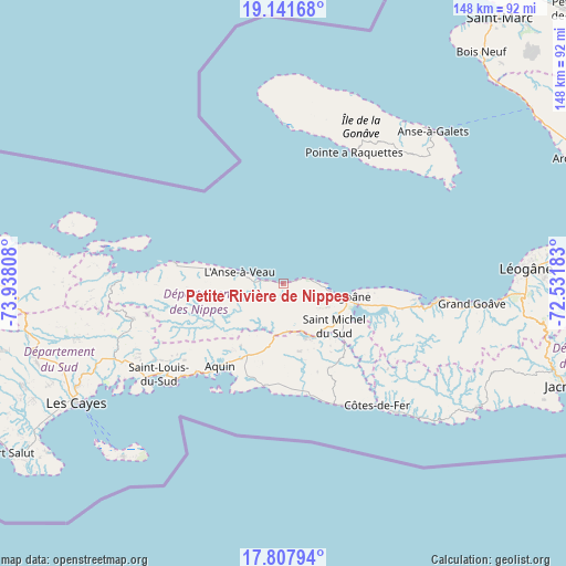
| Upper-left | 19.14168°, | -73.93808° |
| Center: | 18.47611°, | -73.23495° |
| Lower-right: | 17.80794°, | -72.53183° |
| Map W x H: | 148.3×148.3 km | = 92.1×92.1mi |
| max Lat: | 19.93984° ⇑72.6% North |
| Petite Rivière de Nippes: | 18.47611° |
| min Lat: | ⇓27.4% South 18.05° |
| min Long | Petite Rivière | max Long |
| -74.4528° | -73.23495° | -71.72475° |
| W 25.5%⇐ | ⇒74.5% E |
Elevation
Elevation of Petite Rivière de Nippes is 15 m = 49 ft, and this is 130.1 m = 427 ft below average elevation for this country.
| Max E: |
1466 m = 4810 ft | 70.8% |
| Avg. | 145.1 m = 476 ft | |
| Petite Rivière de Nippes | 15 m = 49 ft | |
Min E: |
3 m = 10 ft | 29.2% |
See also: Haiti elevation on elevation.city.
Geographical zone
Petite Rivière de Nippes is located in North Torrid zone (between Equator and Tropic of Cancer). Distance of this Northern Tropic circle is 551.6 km =342.7 mi to North.| Distance of | km | miles | from Petite Rivière de Nippes |
|---|---|---|---|
| North Pole | 7952.7 | 4941.6 | to North |
| Arctic Circle | 5346.8 | 3322.3 | to North |
| Tropic Cancer | 551.6 | 342.7 | to North |
| Equator | 2054.4 | 1276.5 | to South |


Nearby cities:
15 places around Petite Rivière de Nippes: (largest is in red/bold)
• Anse à Galets
55.6 km =34.5 mi,  44°
44°
• Anse-à-Veau
11.9 km =7.4 mi,  283°
283°
• Aquin
27.6 km =17.1 mi,  217°
217°
• Baradères
42.6 km =26.5 mi,  270°
270°
• Cavaillon
48.4 km =30.1 mi,  246°
246°
• Fond des Blancs
24.8 km =15.4 mi,  152°
152°
• Grangwav
49.4 km =30.7 mi,  96°
96°
• Kotdefè
40.3 km =25 mi,  142°
142°
• Lazil
21.5 km =13.4 mi,  241°
241°
• Les Cayes
62.4 km =38.8 mi, 239°
• Léogâne
63.5 km =39.5 mi,  86°
86°
• Miragoâne
15.7 km =9.8 mi, 102°
• Petit Trou de Nippes
29.3 km =18.2 mi, 280°
• Saint-Louis du Sud
40.5 km =25.2 mi,  234°
234°
• Tigwav
39.3 km =24.4 mi, 97°
Sources, notices
• [Note1] Compared only with cities in Haiti existing in our database
• [Src1] Map data: © OpenStreetMap contributors (CC-BY-SA)
• [Src2] Other city data from geonames.org with taken over terms of usage.
• [Src3] Geographical zone / Annual Mean Temperature by Robert A. Rohde @ Wikipedia
