Kotdefè geodata
Kotdefè (Sud-Est) is a populated place; located in Haiti in America/Port-au-Prince (GMT-4) time zone. With population of 2,393 people, there are 68 cities with bigger population in this country. Compared to other cities in Haiti, 96.2% of cities are located further ↑North; 67.9% of cities are located further →East and 90.6% of cities have higher elevation than Kotdefè. Note1


Kotdefè GPS coordinates[2]
18° 11' 19.392" North, 73° 0' 10.332" West
| Map corner | latitude | longitude |
|---|---|---|
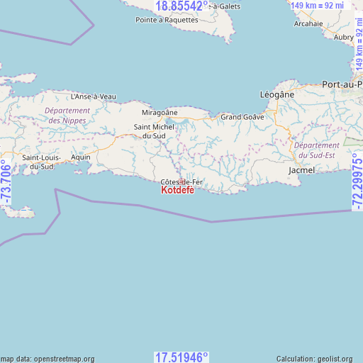
| Upper-left | 18.85542°, | -73.706° |
| Center: | 18.18872°, | -73.00287° |
| Lower-right: | 17.51946°, | -72.29975° |
| Map W x H: | 148.5×148.5 km | = 92.3×92.3mi |
| max Lat: | 19.93984° ⇑96.2% North |
| Kotdefè: | 18.18872° |
| min Lat: | ⇓3.8% South 18.05° |
| min Long | Kotdefè | max Long |
| -74.4528° | -73.00287° | -71.72475° |
| W 32.1%⇐ | ⇒67.9% E |
Elevation
Elevation of Kotdefè is 9 m = 30 ft, and this is 136.1 m = 447 ft below average elevation for this country.
| Max E: |
1466 m = 4810 ft | 90.6% |
| Avg. | 145.1 m = 476 ft | |
| Kotdefè | 9 m = 30 ft | |
Min E: |
3 m = 10 ft | 9.4% |
See also: Haiti elevation on elevation.city.
Geographical zone
Kotdefè is located in North Torrid zone (between Equator and Tropic of Cancer). Distance of this Northern Tropic circle is 583.5 km =362.6 mi to North.| Distance of | km | miles | from Kotdefè |
|---|---|---|---|
| North Pole | 7984.7 | 4961.5 | to North |
| Arctic Circle | 5378.8 | 3342.2 | to North |
| Tropic Cancer | 583.5 | 362.6 | to North |
| Equator | 2022.4 | 1256.7 | to South |


Nearby cities:
15 places around Kotdefè: (largest is in red/bold)
• Anse-à-Veau
50.1 km =31.1 mi,  313°
313°
• Aquin
42.6 km =26.5 mi,  283°
283°
• Cavaillon
69.9 km =43.4 mi, 280°
• Cayes-Jacmel
64.3 km =40 mi,  85°
85°
• Fond des Blancs
16.5 km =10.3 mi, 307°
• Grangwav
36.1 km =22.4 mi,  42°
42°
• Gressier
63.7 km =39.6 mi,  52°
52°
• Jacmel
49.6 km =30.8 mi,  84°
84°
• Lazil
48.6 km =30.2 mi,  296°
296°
• Léogâne
53 km =32.9 mi, 47°
• Miragoâne
30 km =18.6 mi,  342°
342°
• Petit Trou de Nippes
65.1 km =40.5 mi, 305°
• Petite Rivière de Nippes
40.3 km =25 mi,  322°
322°
• Saint-Louis du Sud
57.9 km =36 mi, 278°
• Tigwav
30.6 km =19 mi,  28°
28°
Sources, notices
• [Note1] Compared only with cities in Haiti existing in our database
• [Src1] Map data: © OpenStreetMap contributors (CC-BY-SA)
• [Src2] Other city data from geonames.org with taken over terms of usage.
• [Src3] Geographical zone / Annual Mean Temperature by Robert A. Rohde @ Wikipedia
