Szászvár geodata
Szászvár (Baranya) is a populated place; located in Hungary in Europe/Budapest (GMT+2) time zone. With population of 2,684 people, there are 573 cities with bigger population in this country. Compared to other cities in Hungary, 93.2% of cities are located further ↑North; 79.4% of cities are located further →East and 81.7% of cities have lower elevation than Szászvár. Note1


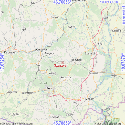
Szászvár GPS coordinates[2]
46° 16' 36.228" North, 18° 22' 32.376" East
| Map corner | latitude | longitude |
|---|---|---|
| Upper-left | 46.76056°, | 17.67254° |
| Center: | 46.27673°, | 18.37566° |
| Lower-right: | 45.78859°, | 19.07879° |
| Map W x H: | 108.1×108.1 km | = 67.2×67.2mi |
| max Lat: | 48.46667° ⇑93.2% North |
| Szászvár: | 46.27673° |
| min Lat: | ⇓6.8% South 45.79108° |
| min Long | Szászvár | max Long |
| 16.27358° | 18.37566° | 22.68096° |
| W 20.6%⇐ | ⇒79.4% E |
Elevation
Elevation of Szászvár is 162 m = 531 ft, and this is 32.3 m = 106 ft above average elevation for this country.
| Max E: |
444 m = 1457 ft | 18.3% |
| Szászvár | 162 m 531 ft | |
| Avg. | 129.7 m = 426 ft | |
Min E: |
71 m = 233 ft | 81.7% |
See also: Hungary elevation on elevation.city.
Geographical zone
Szászvár is located in North temperate zone (between Tropic of Cancer and the Arctic Circle). Distance of this North polar circle is 2255.7 km =1401.6 mi to North.| Distance of | km | miles | from Szászvár |
|---|---|---|---|
| North Pole | 4861.6 | 3020.9 | to North |
| Arctic Circle | 2255.7 | 1401.6 | to North |
| Tropic Cancer | 2539.6 | 1578 | to South |
| Equator | 5145.5 | 3197.3 | to South |


Nearby cities:
15 places around Szászvár: (largest is in red/bold)
• Bonyhád
12.1 km =7.5 mi,  78°
78°
• Dombóvár
21.4 km =13.3 mi,  301°
301°
• Döbrököz
19.2 km =11.9 mi,  327°
327°
• Hidas
9.5 km =5.9 mi,  103°
103°
• Hosszúhetény
12.7 km =7.9 mi,  188°
188°
• Hőgyész
24.7 km =15.3 mi,  7°
7°
• Komló
12.6 km =7.8 mi,  222°
222°
• Mecseknádasd
9.3 km =5.8 mi,  128°
128°
• Mágocs
13.7 km =8.5 mi,  306°
306°
• Nagymányok
6.1 km =3.8 mi,  87°
87°
• Pécs
24.1 km =15 mi,  207°
207°
• Pécsvárad
13.4 km =8.3 mi,  164°
164°
• Szentgálpuszta
22.1 km =13.7 mi,  60°
60°
• Sásd
20.7 km =12.9 mi,  263°
263°
• Zomba
20.9 km =13 mi,  44°
44°
Sources, notices
• [Note1] Compared only with cities in Hungary existing in our database
• [Src1] Map data: © OpenStreetMap contributors (CC-BY-SA)
• [Src2] Other city data from geonames.org with taken over terms of usage.
• [Src3] Geographical zone / Annual Mean Temperature by Robert A. Rohde @ Wikipedia
