Perkáta geodata
Perkáta (Fejér) is a populated place; located in Hungary in Europe/Budapest (GMT+2) time zone. With population of 4,166 people, there are 359 cities with bigger population in this country. Compared to other cities in Hungary, 67.3% of cities are located further ↑North; 71.1% of cities are located further →East and 62.1% of cities have lower elevation than Perkáta. Note1


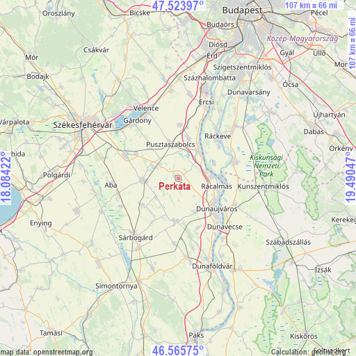
Perkáta GPS coordinates[2]
47° 2' 49.236" North, 18° 47' 14.424" East
| Map corner | latitude | longitude |
|---|---|---|
| Upper-left | 47.52397°, | 18.08422° |
| Center: | 47.04701°, | 18.78734° |
| Lower-right: | 46.56575°, | 19.49047° |
| Map W x H: | 106.5×106.5 km | = 66.2×66.2mi |
| max Lat: | 48.46667° ⇑67.3% North |
| Perkáta: | 47.04701° |
| min Lat: | ⇓32.7% South 45.79108° |
| min Long | Perkáta | max Long |
| 16.27358° | 18.78734° | 22.68096° |
| W 28.9%⇐ | ⇒71.1% E |
Elevation
Elevation of Perkáta is 128 m = 420 ft, and this is 1.7 m = 6 ft below average elevation for this country.
| Max E: |
444 m = 1457 ft | 37.9% |
| Avg. | 129.7 m = 426 ft | |
| Perkáta | 128 m = 420 ft | |
Min E: |
71 m = 233 ft | 62.1% |
See also: Hungary elevation on elevation.city.
Geographical zone
Perkáta is located in North temperate zone (between Tropic of Cancer and the Arctic Circle). Distance of this North polar circle is 2170 km =1348.4 mi to North.| Distance of | km | miles | from Perkáta |
|---|---|---|---|
| North Pole | 4775.9 | 2967.6 | to North |
| Arctic Circle | 2170 | 1348.4 | to North |
| Tropic Cancer | 2625.2 | 1631.2 | to South |
| Equator | 5231.1 | 3250.5 | to South |


Nearby cities:
15 places around Perkáta: (largest is in red/bold)
• Aba
20.2 km =12.6 mi,  264°
264°
• Adony
10 km =6.2 mi,  36°
36°
• Dunaújváros
14.7 km =9.1 mi,  128°
128°
• Dömsöd
17.6 km =10.9 mi,  74°
74°
• Iváncsa
12.4 km =7.7 mi,  11°
11°
• Mezőfalva
12.9 km =8 mi,  185°
185°
• Pusztaszabolcs
10.1 km =6.3 mi,  351°
351°
• Rácalmás
11.9 km =7.4 mi,  103°
103°
• Ráckeve
17.4 km =10.8 mi, 43°
• Seregélyes
18.3 km =11.4 mi,  292°
292°
• Szalkszentmárton
18.8 km =11.7 mi,  114°
114°
• Sárkeresztúr
19 km =11.8 mi, 255°
• Sárosd
10.9 km =6.8 mi,  267°
267°
• Tass
18.6 km =11.6 mi, 98°
• dunaújváros
14.1 km =8.8 mi, 128°
Sources, notices
• [Note1] Compared only with cities in Hungary existing in our database
• [Src1] Map data: © OpenStreetMap contributors (CC-BY-SA)
• [Src2] Other city data from geonames.org with taken over terms of usage.
• [Src3] Geographical zone / Annual Mean Temperature by Robert A. Rohde @ Wikipedia
