Kocsér geodata
Kocsér (Pest) is a populated place; located in Hungary in Europe/Budapest (GMT+2) time zone. With population of 2,096 people, there are 740 cities with bigger population in this country. Compared to other cities in Hungary, 69.2% of cities are located further ↑North; 59.6% of cities are located further ←West and 72.5% of cities have higher elevation than Kocsér. Note1


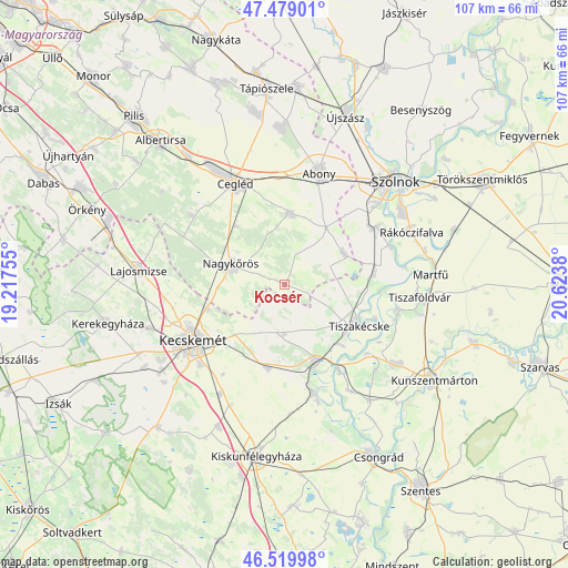
Kocsér GPS coordinates[2]
47° 0' 5.94" North, 19° 55' 14.412" East
| Map corner | latitude | longitude |
|---|---|---|
| Upper-left | 47.47901°, | 19.21755° |
| Center: | 47.00165°, | 19.92067° |
| Lower-right: | 46.51998°, | 20.6238° |
| Map W x H: | 106.6×106.6 km | = 66.2×66.2mi |
| max Lat: | 48.46667° ⇑69.2% North |
| Kocsér: | 47.00165° |
| min Lat: | ⇓30.8% South 45.79108° |
| min Long | Kocsér | max Long |
| 16.27358° | 19.92067° | 22.68096° |
| W 59.6%⇐ | ⇒40.4% E |
Elevation
Elevation of Kocsér is 100 m = 328 ft, and this is 29.7 m = 97 ft below average elevation for this country.
| Max E: |
444 m = 1457 ft | 72.5% |
| Avg. | 129.7 m = 426 ft | |
| Kocsér | 100 m = 328 ft | |
Min E: |
71 m = 233 ft | 27.5% |
See also: Hungary elevation on elevation.city.
Geographical zone
Kocsér is located in North temperate zone (between Tropic of Cancer and the Arctic Circle). Distance of this North polar circle is 2175.1 km =1351.5 mi to North.| Distance of | km | miles | from Kocsér |
|---|---|---|---|
| North Pole | 4781 | 2970.8 | to North |
| Arctic Circle | 2175.1 | 1351.5 | to North |
| Tropic Cancer | 2620.2 | 1628.1 | to South |
| Equator | 5226.1 | 3247.3 | to South |


Nearby cities:
15 places around Kocsér: (largest is in red/bold)
• Abony
21.9 km =13.6 mi,  16°
16°
• Cegléd
21.1 km =13.1 mi,  334°
334°
• Cibakháza
21.5 km =13.4 mi,  102°
102°
• Csemő
21.7 km =13.5 mi,  306°
306°
• Jászkarajenő
12.3 km =7.6 mi,  64°
64°
• Kecskemét
20.4 km =12.7 mi,  238°
238°
• Lakitelek
15.1 km =9.4 mi,  157°
157°
• Nagykőrös
11.4 km =7.1 mi,  288°
288°
• Nyárlőrinc
16.1 km =10 mi,  191°
191°
• Szentkirály
9.2 km =5.7 mi,  181°
181°
• Tiszaalpár
21.8 km =13.5 mi, 164°
• Tiszakécske
15.9 km =9.9 mi,  118°
118°
• Tószeg
20.5 km =12.7 mi, 57°
• Törtel
13.4 km =8.3 mi,  5°
5°
• Városföld
24 km =14.9 mi,  211°
211°
Sources, notices
• [Note1] Compared only with cities in Hungary existing in our database
• [Src1] Map data: © OpenStreetMap contributors (CC-BY-SA)
• [Src2] Other city data from geonames.org with taken over terms of usage.
• [Src3] Geographical zone / Annual Mean Temperature by Robert A. Rohde @ Wikipedia
