Kiskunfélegyháza geodata
Kiskunfélegyháza (Bács-Kiskun) is a seat of a second-order administrative division; located in Hungary in Europe/Budapest (GMT+2) time zone. With population of 31,720 people, there are 56 cities with bigger population in this country. Compared to other cities in Hungary, 80.1% of cities are located further ↑North; 58.1% of cities are located further ←West and 77% of cities have higher elevation than Kiskunfélegyháza. Note1


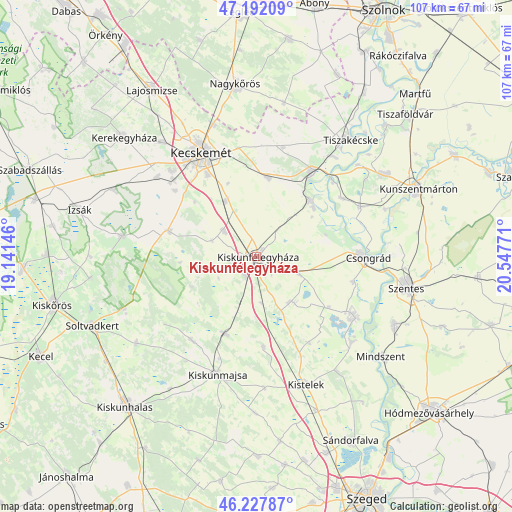
Kiskunfélegyháza GPS coordinates[2]
46° 42' 43.668" North, 19° 50' 40.488" East
| Map corner | latitude | longitude |
|---|---|---|
| Upper-left | 47.19209°, | 19.14146° |
| Center: | 46.71213°, | 19.84458° |
| Lower-right: | 46.22787°, | 20.54771° |
| Map W x H: | 107.2×107.2 km | = 66.6×66.6mi |
| max Lat: | 48.46667° ⇑80.1% North |
| Kiskunfélegyháza: | 46.71213° |
| min Lat: | ⇓19.9% South 45.79108° |
| min Long | Kiskunfélegyh� | max Long |
| 16.27358° | 19.84458° | 22.68096° |
| W 58.1%⇐ | ⇒41.9% E |
Elevation
Elevation of Kiskunfélegyháza is 97 m = 318 ft, and this is 32.7 m = 107 ft below average elevation for this country.
| Max E: |
444 m = 1457 ft | 77% |
| Avg. | 129.7 m = 426 ft | |
| Kiskunfélegyháza | 97 m = 318 ft | |
Min E: |
71 m = 233 ft | 23% |
See also: Hungary elevation on elevation.city.
Geographical zone
Kiskunfélegyháza is located in North temperate zone (between Tropic of Cancer and the Arctic Circle). Distance of this North polar circle is 2207.3 km =1371.6 mi to North.| Distance of | km | miles | from Kiskunfélegyháza |
|---|---|---|---|
| North Pole | 4813.2 | 2990.8 | to North |
| Arctic Circle | 2207.3 | 1371.6 | to North |
| Tropic Cancer | 2588 | 1608.1 | to South |
| Equator | 5193.9 | 3227.3 | to South |


Nearby cities:
15 places around Kiskunfélegyháza: (largest is in red/bold)
• Bugac
12.8 km =8 mi,  257°
257°
• Csengele
18.9 km =11.7 mi,  175°
175°
• Csongrád
22.7 km =14.1 mi,  89°
89°
• Fülöpjakab
10 km =6.2 mi,  289°
289°
• Helvécia
21.9 km =13.6 mi,  309°
309°
• Jászszentlászló
17.4 km =10.8 mi,  201°
201°
• Lakitelek
21.5 km =13.4 mi,  32°
32°
• Nyárlőrinc
16.7 km =10.4 mi,  8°
8°
• Pusztaszer
21 km =13 mi,  148°
148°
• Pálmonostora
12.7 km =7.9 mi,  140°
140°
• Szank
22.2 km =13.8 mi,  219°
219°
• Szentkirály
23.7 km =14.7 mi, 13°
• Tiszaalpár
16.2 km =10.1 mi,  46°
46°
• Tömörkény
18.5 km =11.5 mi,  124°
124°
• Városföld
13.4 km =8.3 mi,  330°
330°
Sources, notices
• [Note1] Compared only with cities in Hungary existing in our database
• [Src1] Map data: © OpenStreetMap contributors (CC-BY-SA)
• [Src2] Other city data from geonames.org with taken over terms of usage.
• [Src3] Geographical zone / Annual Mean Temperature by Robert A. Rohde @ Wikipedia
