Szank geodata
Szank (Bács-Kiskun) is a populated place; located in Hungary in Europe/Budapest (GMT+2) time zone. With population of 2,506 people, there are 613 cities with bigger population in this country. Compared to other cities in Hungary, 84% of cities are located further ↑North; 53.5% of cities are located further ←West and 62.4% of cities have higher elevation than Szank. Note1


Szank GPS coordinates[2]
46° 33' 25.668" North, 19° 39' 39.708" East
| Map corner | latitude | longitude |
|---|---|---|
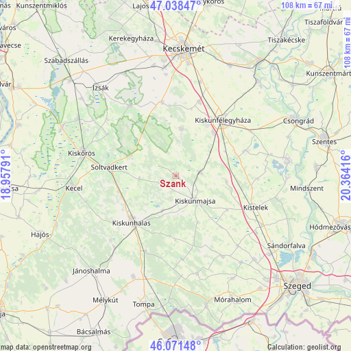
| Upper-left | 47.03847°, | 18.95791° |
| Center: | 46.55713°, | 19.66103° |
| Lower-right: | 46.07148°, | 20.36416° |
| Map W x H: | 107.5×107.5 km | = 66.8×66.8mi |
| max Lat: | 48.46667° ⇑84% North |
| Szank: | 46.55713° |
| min Lat: | ⇓16% South 45.79108° |
| min Long | Szank | max Long |
| 16.27358° | 19.66103° | 22.68096° |
| W 53.5%⇐ | ⇒46.5% E |
Elevation
Elevation of Szank is 108 m = 354 ft, and this is 21.7 m = 71 ft below average elevation for this country.
| Max E: |
444 m = 1457 ft | 62.4% |
| Avg. | 129.7 m = 426 ft | |
| Szank | 108 m = 354 ft | |
Min E: |
71 m = 233 ft | 37.6% |
See also: Hungary elevation on elevation.city.
Geographical zone
Szank is located in North temperate zone (between Tropic of Cancer and the Arctic Circle). Distance of this North polar circle is 2224.5 km =1382.2 mi to North.| Distance of | km | miles | from Szank |
|---|---|---|---|
| North Pole | 4830.4 | 3001.5 | to North |
| Arctic Circle | 2224.5 | 1382.2 | to North |
| Tropic Cancer | 2570.7 | 1597.4 | to South |
| Equator | 5176.7 | 3216.7 | to South |


Nearby cities:
15 places around Szank: (largest is in red/bold)
• Bugac
14.5 km =9 mi,  5°
5°
• Csengele
15.6 km =9.7 mi,  96°
96°
• Forráskút
28.6 km =17.8 mi,  138°
138°
• Fülöpjakab
21.1 km =13.1 mi, 12°
• Jászszentlászló
7.7 km =4.8 mi,  81°
81°
• Kiskunfélegyháza
22.2 km =13.8 mi,  39°
39°
• Kiskunhalas
19.2 km =11.9 mi,  224°
224°
• Kiskunmajsa
9.6 km =6 mi, 140°
• Kistelek
26.1 km =16.2 mi,  111°
111°
• Orgovány
25.9 km =16.1 mi,  326°
326°
• Pusztaszer
25 km =15.5 mi,  91°
91°
• Pálmonostora
23.4 km =14.5 mi,  71°
71°
• Soltvadkert
20.6 km =12.8 mi,  276°
276°
• Tázlár
11.3 km =7 mi,  264°
264°
• Üllés
28.3 km =17.6 mi,  150°
150°
Sources, notices
• [Note1] Compared only with cities in Hungary existing in our database
• [Src1] Map data: © OpenStreetMap contributors (CC-BY-SA)
• [Src2] Other city data from geonames.org with taken over terms of usage.
• [Src3] Geographical zone / Annual Mean Temperature by Robert A. Rohde @ Wikipedia
