Jászszentlászló geodata
Jászszentlászló (Bács-Kiskun) is a populated place; located in Hungary in Europe/Budapest (GMT+2) time zone. With population of 2,602 people, there are 594 cities with bigger population in this country. Compared to other cities in Hungary, 83.8% of cities are located further ↑North; 56.6% of cities are located further ←West and 74.5% of cities have higher elevation than Jászszentlászló. Note1


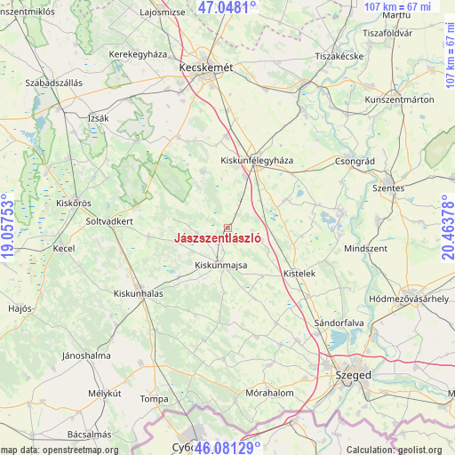
Jászszentlászló GPS coordinates[2]
46° 34' 0.66" North, 19° 45' 38.34" East
| Map corner | latitude | longitude |
|---|---|---|
| Upper-left | 47.0481°, | 19.05753° |
| Center: | 46.56685°, | 19.76065° |
| Lower-right: | 46.08129°, | 20.46378° |
| Map W x H: | 107.5×107.5 km | = 66.8×66.8mi |
| max Lat: | 48.46667° ⇑83.8% North |
| Jászszentlászló: | 46.56685° |
| min Lat: | ⇓16.2% South 45.79108° |
| min Long | Jászszentlász | max Long |
| 16.27358° | 19.76065° | 22.68096° |
| W 56.6%⇐ | ⇒43.4% E |
Elevation
Elevation of Jászszentlászló is 99 m = 325 ft, and this is 30.7 m = 101 ft below average elevation for this country.
| Max E: |
444 m = 1457 ft | 74.5% |
| Avg. | 129.7 m = 426 ft | |
| Jászszentlászló | 99 m = 325 ft | |
Min E: |
71 m = 233 ft | 25.5% |
See also: Hungary elevation on elevation.city.
Geographical zone
Jászszentlászló is located in North temperate zone (between Tropic of Cancer and the Arctic Circle). Distance of this North polar circle is 2223.4 km =1381.6 mi to North.| Distance of | km | miles | from Jászszentlászló |
|---|---|---|---|
| North Pole | 4829.3 | 3000.8 | to North |
| Arctic Circle | 2223.4 | 1381.6 | to North |
| Tropic Cancer | 2571.8 | 1598 | to South |
| Equator | 5177.7 | 3217.3 | to South |


Nearby cities:
15 places around Jászszentlászló: (largest is in red/bold)
• Baks
26.2 km =16.3 mi,  95°
95°
• Balástya
24.8 km =15.4 mi,  130°
130°
• Bugac
14.7 km =9.1 mi,  335°
335°
• Csengele
8.3 km =5.2 mi,  109°
109°
• Forráskút
25.2 km =15.7 mi,  153°
153°
• Fülöpjakab
19.7 km =12.2 mi,  351°
351°
• Kiskunfélegyháza
17.4 km =10.8 mi,  21°
21°
• Kiskunhalas
25.8 km =16 mi,  235°
235°
• Kiskunmajsa
8.7 km =5.4 mi,  190°
190°
• Kistelek
19.8 km =12.3 mi,  122°
122°
• Pusztaszer
17.5 km =10.9 mi, 95°
• Pálmonostora
15.9 km =9.9 mi,  66°
66°
• Szank
7.7 km =4.8 mi,  261°
261°
• Tázlár
18.9 km =11.7 mi, 263°
• Tömörkény
22.3 km =13.9 mi,  75°
75°
Sources, notices
• [Note1] Compared only with cities in Hungary existing in our database
• [Src1] Map data: © OpenStreetMap contributors (CC-BY-SA)
• [Src2] Other city data from geonames.org with taken over terms of usage.
• [Src3] Geographical zone / Annual Mean Temperature by Robert A. Rohde @ Wikipedia
