Szakcs geodata
Szakcs (Tolna) is a populated place; located in Hungary in Europe/Budapest (GMT+2) time zone. With population of 954 people, there are 875 cities with bigger population in this country. Compared to other cities in Hungary, 84.8% of cities are located further ↑North; 84.5% of cities are located further →East and 86.8% of cities have lower elevation than Szakcs. Note1


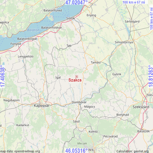
Szakcs GPS coordinates[2]
46° 32' 20.292" North, 18° 6' 34.2" East
| Map corner | latitude | longitude |
|---|---|---|
| Upper-left | 47.02047°, | 17.40638° |
| Center: | 46.53897°, | 18.1095° |
| Lower-right: | 46.05316°, | 18.81263° |
| Map W x H: | 107.6×107.6 km | = 66.9×66.9mi |
| max Lat: | 48.46667° ⇑84.8% North |
| Szakcs: | 46.53897° |
| min Lat: | ⇓15.2% South 45.79108° |
| min Long | Szakcs | max Long |
| 16.27358° | 18.1095° | 22.68096° |
| W 15.5%⇐ | ⇒84.5% E |
Elevation
Elevation of Szakcs is 178 m = 584 ft, and this is 48.3 m = 158 ft above average elevation for this country.
| Max E: |
444 m = 1457 ft | 13.2% |
| Szakcs | 178 m 584 ft | |
| Avg. | 129.7 m = 426 ft | |
Min E: |
71 m = 233 ft | 86.8% |
See also: Hungary elevation on elevation.city.
Geographical zone
Szakcs is located in North temperate zone (between Tropic of Cancer and the Arctic Circle). Distance of this North polar circle is 2226.5 km =1383.5 mi to North.| Distance of | km | miles | from Szakcs |
|---|---|---|---|
| North Pole | 4832.4 | 3002.7 | to North |
| Arctic Circle | 2226.5 | 1383.5 | to North |
| Tropic Cancer | 2568.7 | 1596.1 | to South |
| Equator | 5174.6 | 3215.3 | to South |


Nearby cities:
15 places around Szakcs: (largest is in red/bold)
• Dombóvár
18.2 km =11.3 mi,  173°
173°
• Döbrököz
16.4 km =10.2 mi,  142°
142°
• Gyönk
28.2 km =17.5 mi,  86°
86°
• Gödre
30 km =18.6 mi,  200°
200°
• Hőgyész
24.1 km =15 mi,  101°
101°
• Iregszemcse
18.1 km =11.2 mi,  18°
18°
• Kaposvár
30.5 km =19 mi,  231°
231°
• Karád
26.5 km =16.5 mi,  309°
309°
• Mágocs
23 km =14.3 mi,  155°
155°
• Ozora
32.4 km =20.1 mi,  43°
43°
• Pincehely
29.7 km =18.5 mi,  57°
57°
• Sásd
31.6 km =19.6 mi,  180°
180°
• Tab
22.2 km =13.8 mi,  344°
344°
• Tamási
16.9 km =10.5 mi,  51°
51°
• Taszár
24 km =14.9 mi,  220°
220°
Sources, notices
• [Note1] Compared only with cities in Hungary existing in our database
• [Src1] Map data: © OpenStreetMap contributors (CC-BY-SA)
• [Src2] Other city data from geonames.org with taken over terms of usage.
• [Src3] Geographical zone / Annual Mean Temperature by Robert A. Rohde @ Wikipedia
