Esztergom geodata
Esztergom (Komárom-Esztergom) is a seat of a second-order administrative division; located in Hungary in Europe/Budapest (GMT+2) time zone. With population of 28,785 people, there are 62 cities with bigger population in this country. Compared to other cities in Hungary, 76.8% of cities are located further ↓South; 72.5% of cities are located further →East and 59.7% of cities have higher elevation than Esztergom. Note1


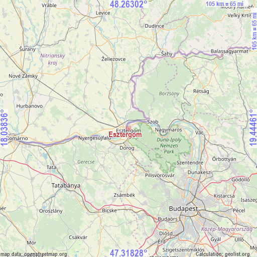
Esztergom GPS coordinates[2]
47° 47' 34.08" North, 18° 44' 29.328" East
| Map corner | latitude | longitude |
|---|---|---|
| Upper-left | 48.26302°, | 18.03836° |
| Center: | 47.7928°, | 18.74148° |
| Lower-right: | 47.31828°, | 19.44461° |
| Map W x H: | 105×105 km | = 65.2×65.2mi |
| max Lat: | 48.46667° ⇑23.2% North |
| Esztergom: | 47.7928° |
| min Lat: | ⇓76.8% South 45.79108° |
| min Long | Esztergom | max Long |
| 16.27358° | 18.74148° | 22.68096° |
| W 27.5%⇐ | ⇒72.5% E |
Elevation
Elevation of Esztergom is 110 m = 361 ft, and this is 19.7 m = 65 ft below average elevation for this country.
| Max E: |
444 m = 1457 ft | 59.7% |
| Avg. | 129.7 m = 426 ft | |
| Esztergom | 110 m = 361 ft | |
Min E: |
71 m = 233 ft | 40.3% |
See also: Hungary elevation on elevation.city.
Geographical zone
Esztergom is located in North temperate zone (between Tropic of Cancer and the Arctic Circle). Distance of this North polar circle is 2087.1 km =1296.9 mi to North.| Distance of | km | miles | from Esztergom |
|---|---|---|---|
| North Pole | 4693 | 2916.1 | to North |
| Arctic Circle | 2087.1 | 1296.9 | to North |
| Tropic Cancer | 2708.1 | 1682.7 | to South |
| Equator | 5314.1 | 3302 | to South |


Nearby cities:
15 places around Esztergom: (largest is in red/bold)
• Csolnok
11.5 km =7.1 mi,  189°
189°
• Dorog
8 km =5 mi,  182°
182°
• Kesztölc
10 km =6.2 mi,  153°
153°
• Nagymaros
16.3 km =10.1 mi,  90°
90°
• Nyergesújfalu
14.3 km =8.9 mi,  255°
255°
• Piliscsaba
18.8 km =11.7 mi,  159°
159°
• Piliscsév
13.9 km =8.6 mi, 155°
• Pilismarót
10 km =6.2 mi,  95°
95°
• Pilisszentkereszt
16.6 km =10.3 mi,  132°
132°
• Pilisszántó
17.6 km =10.9 mi,  141°
141°
• Szob
10.1 km =6.3 mi,  73°
73°
• Sárisáp
13.7 km =8.5 mi,  199°
199°
• Tokod
9.9 km =6.2 mi,  218°
218°
• Tát
9 km =5.6 mi,  230°
230°
• Visegrád
17.2 km =10.7 mi, 92°
In other languages:
- In France: Esztergom, Strigonie
- In German: Gran, Esztergom
- In Italian: Strigonio, Esztergom
- In Russian: Эстергом
- In Chinese: 埃斯泰尔戈姆
Sources, notices
• [Note1] Compared only with cities in Hungary existing in our database
• [Src1] Map data: © OpenStreetMap contributors (CC-BY-SA)
• [Src2] Other city data from geonames.org with taken over terms of usage.
• [Src3] Geographical zone / Annual Mean Temperature by Robert A. Rohde @ Wikipedia
