Tubei geodata
Tubei (Bengkulu) is a seat of a second-order administrative division; located in Indonesia in Asia/Jakarta (GMT+7) time zone. In our database, there are 407 cities with bigger population. Compared to other cities in Indonesia, 91% of cities are located further ↓South; 96% of cities are located further →East and 73% of cities have lower elevation than Tubei. Note1


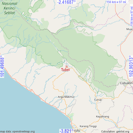
Tubei GPS coordinates[2]
3° 7' 9.012" South, 102° 12' 0" East
| Map corner | latitude | longitude |
|---|---|---|
| Upper-left | -2.41687°, | 101.49688° |
| Center: | -3.11917°, | 102.2° |
| Lower-right: | -3.821°, | 102.90313° |
| Map W x H: | 156.1×156.1 km | = 97×97mi |
| max Lat: | 5.88969° ⇑9% North |
| Tubei: | -3.11917° |
| min Lat: | ⇓91% South -10.934° |
| min Long | Tubei | max Long |
| 95.1345° | 102.2° | 140.9419° |
| W 4%⇐ | ⇒96% E |
Elevation
Elevation of Tubei is 335 m = 1099 ft, and this is 105.3 m = 345 ft above average elevation for this country.
| Max E: |
3185 m = 10449 ft | 27% |
| Tubei | 335 m 1099 ft | |
| Avg. | 229.7 m = 754 ft | |
Min E: |
-1 m = -3 ft | 73% |
See also: Indonesia elevation on elevation.city.
Geographical zone
Tubei is located in South Torrid zone (between Equator and Tropic of Capricorn). Distance of Equator is 346.8 km =215.5 mi to North.| Distance of | km | miles | from Tubei |
|---|---|---|---|
| Equator | 346.8 | 215.5 | to North |
| Tropic Capricorn | 2259.1 | 1403.7 | to South |
| Antarctic Circle | 7054.4 | 4383.4 | to South |
| South Pole | 9660.2 | 6002.6 | to South |


Nearby cities:
15 places around Tubei: (largest is in red/bold)
• Argamakmur
33.8 km =21 mi,  182°
182°
• Bengkulu
76.1 km =47.3 mi,  174°
174°
• Curup
52.8 km =32.8 mi,  137°
137°
• Ipuh
80.5 km =50 mi,  278°
278°
• Jangkat
69.9 km =43.4 mi,  346°
346°
• Karang Tinggi
74.4 km =46.2 mi,  160°
160°
• Kepahiang
71.6 km =44.5 mi, 144°
• Ketahun
50.4 km =31.3 mi,  233°
233°
• Lais
48.6 km =30.2 mi,  200°
200°
• Lubuklinggau
76 km =47.2 mi,  104°
104°
• Muararupit
90.4 km =56.2 mi,  60°
60°
• Padangulaktanding
72.4 km =45 mi,  113°
113°
• Rantaupangiang
69.5 km =43.2 mi,  4°
4°
• Surulangun Rawas
83.4 km =51.8 mi,  48°
48°
• Terawas
68.7 km =42.7 mi,  83°
83°
Sources, notices
• [Note1] Compared only with cities in Indonesia existing in our database
• [Src1] Map data: © OpenStreetMap contributors (CC-BY-SA)
• [Src2] Other city data from geonames.org with taken over terms of usage.
• [Src3] Geographical zone / Annual Mean Temperature by Robert A. Rohde @ Wikipedia
